

Perimeter provides everything needed to create, manage, and communicate zones, points, and routes for emergencies and planned events.
Request a DemoPerimeter Platform
Perimeter Platform
Perimeter provides everything needed to create, manage, and communicate zones, points, and routes for emergencies and planned events.
Request a Demo


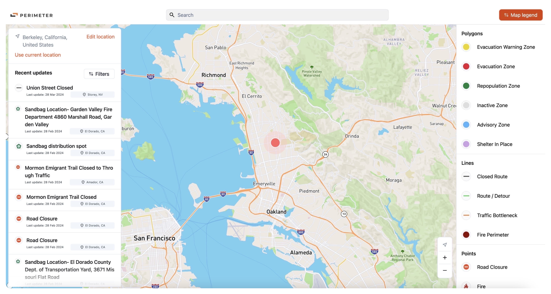
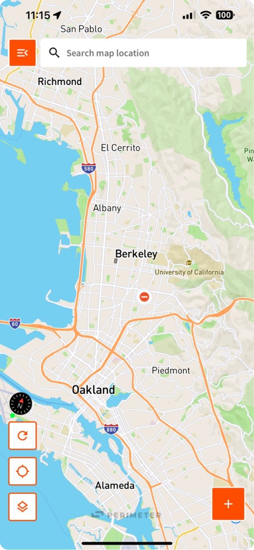
Real-time updates from the field, make selected information visible to the public
Platform Overview
Fear thrives in the dark. Seize control of the narrative with a live, authoritative map that cuts through the rumors. When your community can see what's happening, they stop guessing, trust the order, and take action.


How Perimeter Works
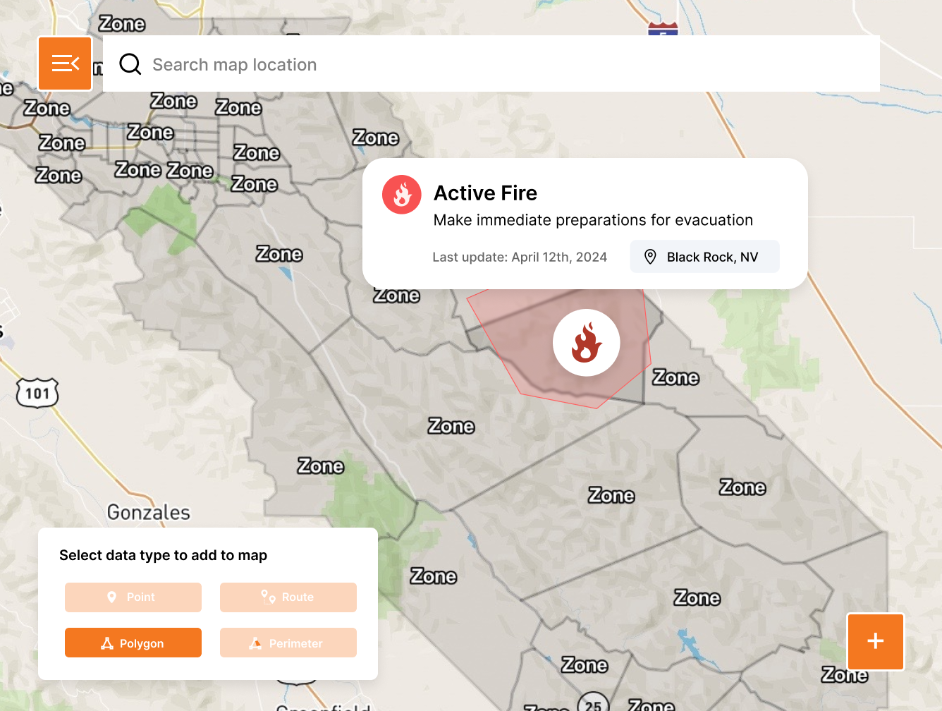
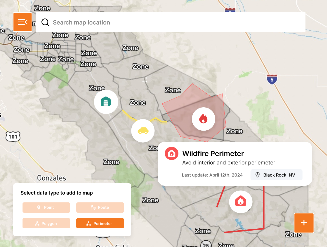
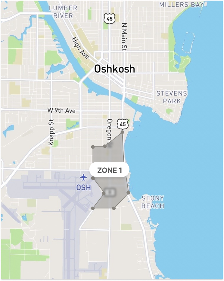
Zones
Create pre-planned or ad hoc zones to ensure your residents and visitors have the best possible information.
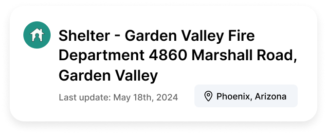
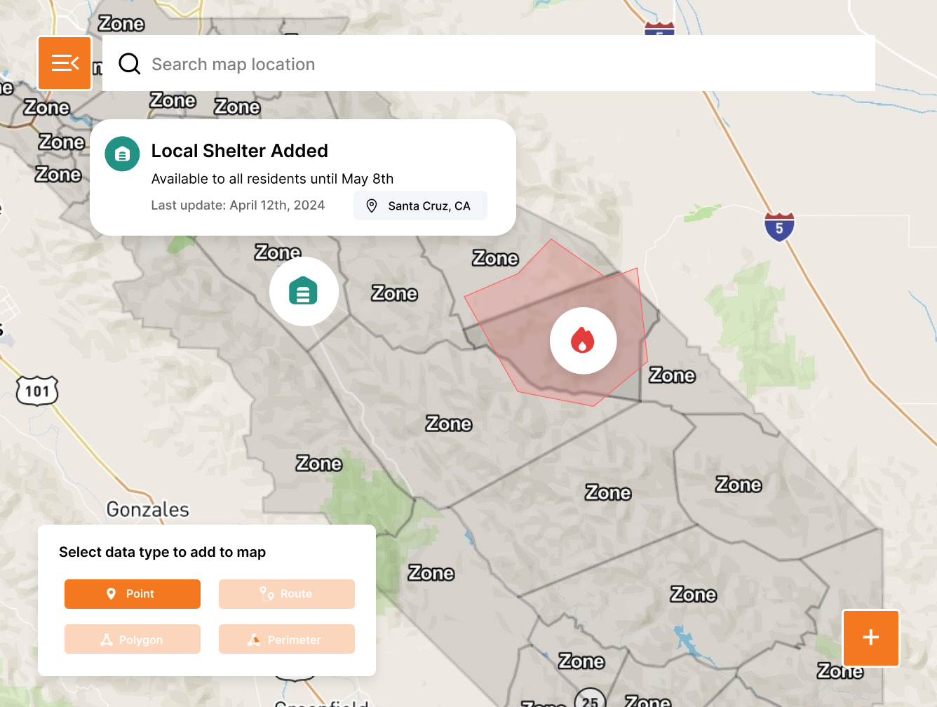
Points
Points include shelters, road closures, resource distribution sites, hazards, at risk facilities, and other common information required during incidents.
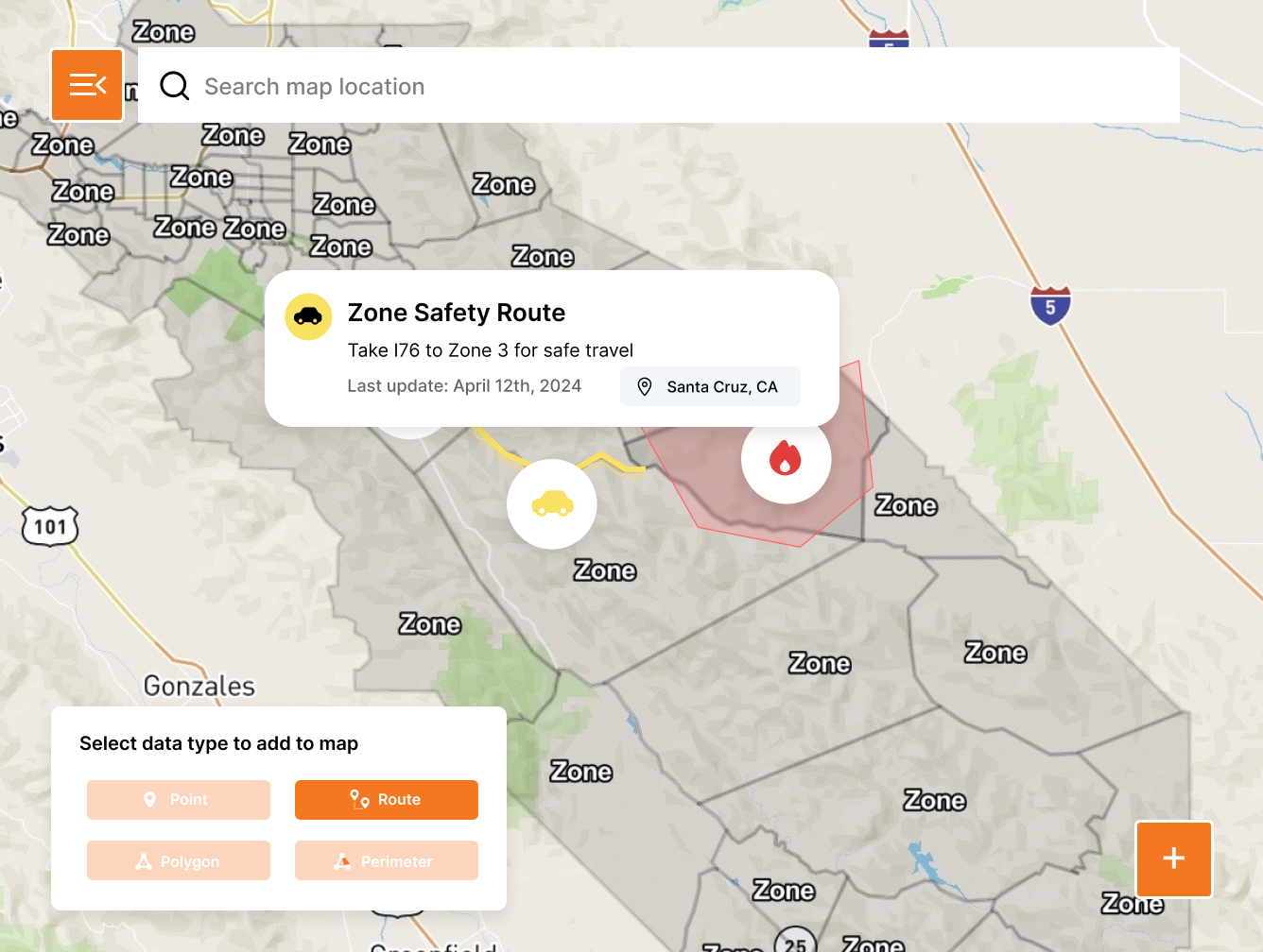
Routes
Create preset or ad hoc routes to ensure that the citizens you serve have the best possible information.
Perimeters
Create open ended shapes to communicate the path of travel for events with unknown impacts.
Every hazard covered

Severe Weather
Show impacted areas, hazards, and critical resources

Flood
Set pre-planned flood zones and update active areas as events unfold in real-time

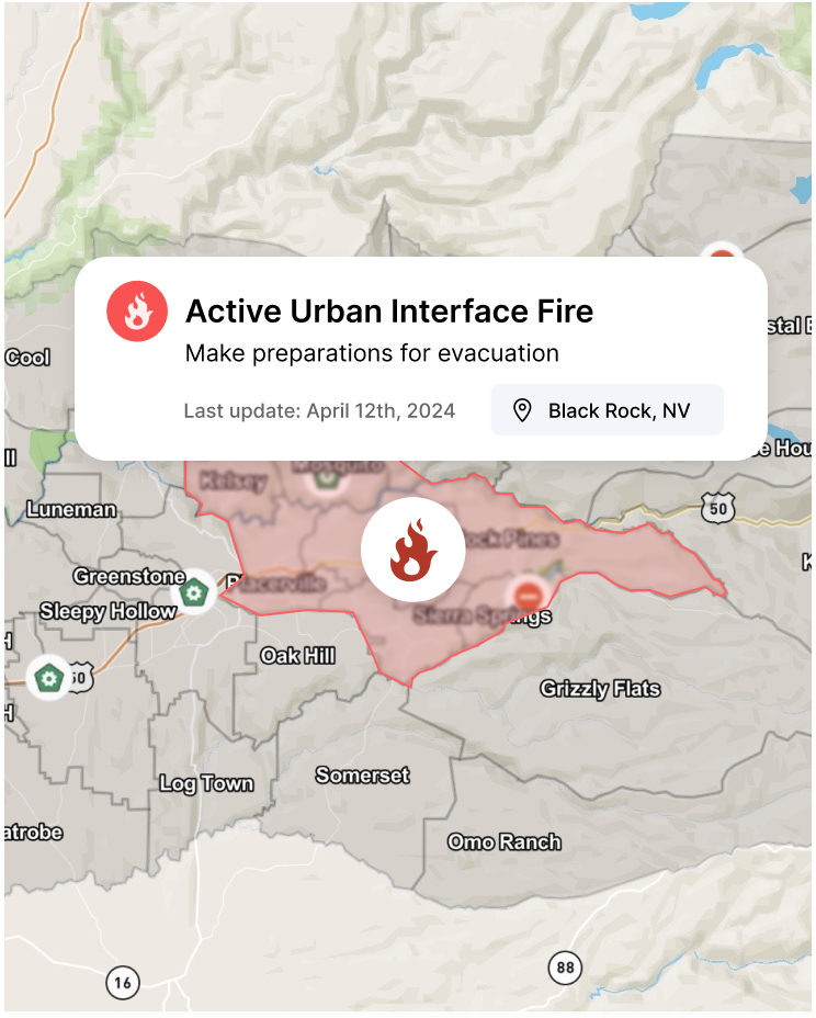
Wildfire
Set active zones and potential spread areas to help with awareness and evacuation

Hurricane
Create risk zones and potential flood and wind areas to minimize public impact

Tornado
Quickly create and edit tornado paths based on up-to-date weather information

Active Assailant
In seconds, create and share critical info related to recovery from active assailant events such as reunification areas

Hazardous Material Spill
Highlight initial isolation zones, hot, warm and cold zones, and manage evacuation of residents.

Mass Casualty Incident
See road closures, detours, and reunification areas

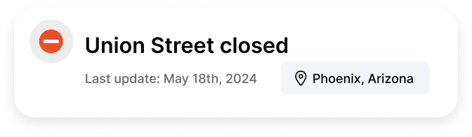
Bomb Threat
Immediately create risk zones and publish to the map for public consumption

Fire
Create zones and perimeters to help track and forecast fire movement and risk

Civil Unrest
Share key risk areas with the public and edit based on crowd movement and escalation

First Amendment Activities
Pre-plan protests and rallies to keep the public informed and safe
Perimeter Features

Quick & easy onboarding
Get started in minutes, not days or weeks. Perimeter is the fastest and most intuitive solution available on the market.
15-minute setup
Custom map creation
On-going support

Full team management
Perimeter makes it easy to manage your teams, create administrators, and share information between agencies and jurisdictions.
Add/remove users
Set administrators
Shared information

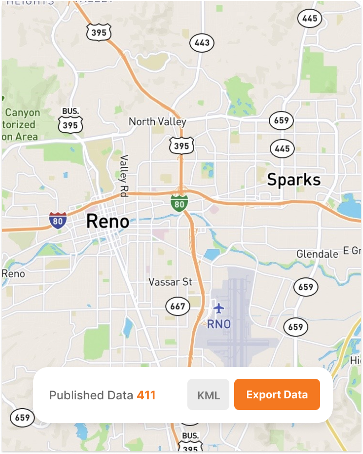
Seamless data integrations
Easily access all data created in Perimeter to leverage across existing communication channels currently implemented in your org.
KML
GeoJSON
Esri
“The Perimeter Platform was easy to learn and easy to use, and we were able to use Perimeter with our existing processes to provide immediate and up-to-date information about evacuation zones, hazardous and closed roads, and sandbag and shelter locations.”

Aaron Rosenberg, Captain
Merced County Sheriff
Planning
Be Ready Before the Call: Don’t start from scratch. Create your zones, set your evacuation routes, and tag critical infrastructure now. When the alarm rings, just flip the switch.
Response
Manage the Chaos: Update road closures, hazard points, and staging areas live. Changes you make sync instantly to everyone’s device from the EOC to the fire truck.
Recovery
Prove Your Work: Every edit and update is automatically logged. Simplify your FEMA reimbursement and debriefs with an event-history replay.

Ready for Any Threat
Manage all hazards from wildfires and floods to hurricanes and active assailants. Don’t switch tools when the mission changes. Manage every incident on a single, unified platform.

Prevent Skill Fade
Don’t let the software sit gathering dust. Use Perimeter for 4th of July parades and marathons so your team is muscle-memory ready when the real disaster hits.

Zero Learning Curve
Most government software requires a PhD to operate. We don't. Your staff and volunteers will be up and running in 15 minutes. No multi-day seminars required.

Partners, Not Vendors
At Perimeter, you’re part of the family. Get 24/7/365 direct access to a US-based support team that understands the urgency of your mission, and stays with you long after the contract is signed.
"Perimeter has revolutionized our emergency communication system by providing an all-risk solution that enables efficient evacuation management, information sharing, and collaboration across different disciplines and jurisdictions."

Mary Campbell
Public Information Officer – Lodi, CA
"The Perimeter Platform was easy to learn and easy to use, and we were able to use Perimeter with our existing processes to provide immediate and up-to-date information about evacuation zones, hazardous and closed roads, and sandbag and shelter locations."
Aaron Rosenberg, Captain
Merced County Sheriff
"The problem is consistent, concise messaging. Other platforms have issues with this basic messaging feature. Perimeter offers a platform that allows the authorities to keep the messaging in real-time, with viable information, at a fraction of the cost."

Ryan Sommers, Fire Chief
North Lake Tahoe Protection District, NV
"Perimeter is a one stop shop for all the information the public needs during and emergency. You don’t have to sign up for it, it’s just a website you go to. It’s good for the community and you can do it from your phone in 60 seconds."

Troy Morton, Lieutenant OES Director
El Dorado County Sheriff’s Office, CA
Replace static PDF maps and radio chatter with a single, real-time operating picture that keeps everyone safe.
Request a Demo