

Perimeter provides the disaster and day-to-day event communication tools you need to keep the citizens you serve safe and informed.
Request a DemoPerimeter Platform
Perimeter Platform
Perimeter provides the disaster and day-to-day event communication tools you need to keep the citizens you serve safe and informed.
Request a Demo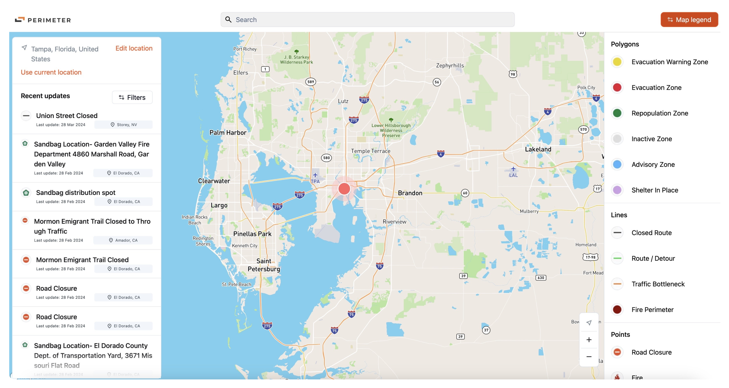


Planning
Quickly setup, review, and publish your Perimeter zones to enable immediate action whenever and wherever disaster happens.
Create custom zones
Get full support to create custom zones, based on your unique situation and needs.
Review and edit zones
Collaborate directly with the Perimeter team to refine zones and other resources.
Publish zones and key data to Perimeter
Set your zones and data live in the click of a button, immediately viewable by your team and the community you serve.

Response
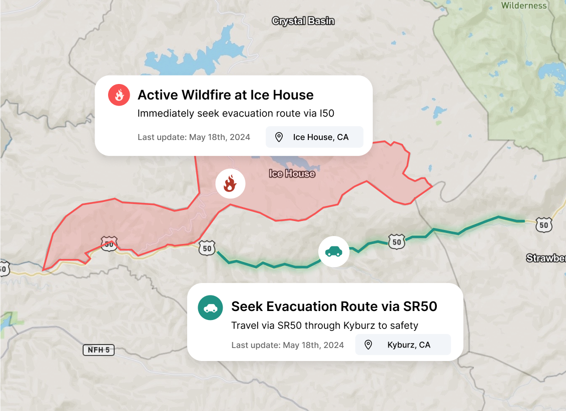
Add data, create public messages, and publish in seconds to keep your community out of harms way.
Add real-time data
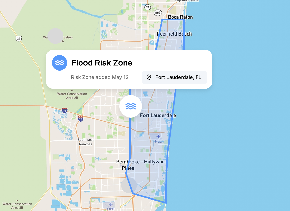
Toggle on pre-planned zones and input ad hoc hazards when disaster strikes.
Curate public messaging
Curate messaging that will be viewable to the public when published.
Publish & manage data instanteously
Publish and view hazards in real-time with our public-facing Perimeter Map.

Recovery
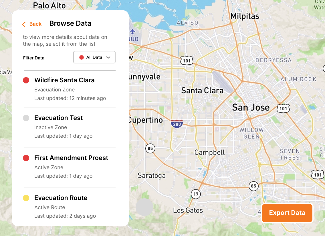
Create, store, and analyze Perimeter data to understand the actions taken by emergency managers and first responders while bolstering your existing data sources.
Retrieve stored data
Easily view and access historic data in the Perimeter App.
After action analysis
Leverage Perimeter's stored data to support comprehensive after action analysis.
Response to public records requests
Ensure you have every detail saved and ready to share when records are requested by your stakeholders.
From incident to recovery Perimeter’s planned and ad hoc features allow emergency managers, public information officers, and tactical workers to execute in the field.

Ready for Any Threat
Manage all hazards from wildfires and floods to hurricanes and active assailants. Don’t switch tools when the mission changes. Manage every incident on a single, unified platform.

Prevent Skill Fade
Don’t let the software sit gathering dust. Use Perimeter for 4th of July parades and marathons so your team is muscle-memory ready when the real disaster hits.

Zero Learning Curve
Most government software requires a PhD to operate. We don't. Your staff and volunteers will be up and running in 15 minutes. No multi-day seminars required.

Partners, Not Vendors
At Perimeter, you’re part of the family. Get 24/7/365 direct access to a US-based support team that understands the urgency of your mission, and stays with you long after the contract is signed.
"Perimeter has revolutionized our emergency communication system by providing an all-risk solution that enables efficient evacuation management, information sharing, and collaboration across different disciplines and jurisdictions."

Mary Campbell
Public Information Officer – Lodi, CA
"The Perimeter Platform was easy to learn and easy to use, and we were able to use Perimeter with our existing processes to provide immediate and up-to-date information about evacuation zones, hazardous and closed roads, and sandbag and shelter locations."

Aaron Rosenberg, Captain
Merced County Sheriff
"The problem is consistent, concise messaging. Other platforms have issues with this basic messaging feature. Perimeter offers a platform that allows the authorities to keep the messaging in real-time, with viable information, at a fraction of the cost."

Ryan Sommers, Fire Chief
North Lake Tahoe Protection District, NV
"Perimeter is a one stop shop for all the information the public needs during and emergency. You don’t have to sign up for it, it’s just a website you go to. It’s good for the community and you can do it from your phone in 60 seconds."

Troy Morton, Lieutenant OES Director
El Dorado County Sheriff’s Office, CA
Replace static PDF maps and radio chatter with a single, real-time operating picture that keeps everyone safe.
Request a Demo

