

Perimeter Map brings agencies onto one shared map, so anyone can add or update zones, points, and routes in seconds, then share that same trusted map with the public using a single link.
Request a DemoPERIMETER MAP
PERIMETER MAP
Perimeter Map brings agencies onto one shared map, so anyone can add or update zones, points, and routes in seconds, then share that same trusted map with the public using a single link.
Request a Demo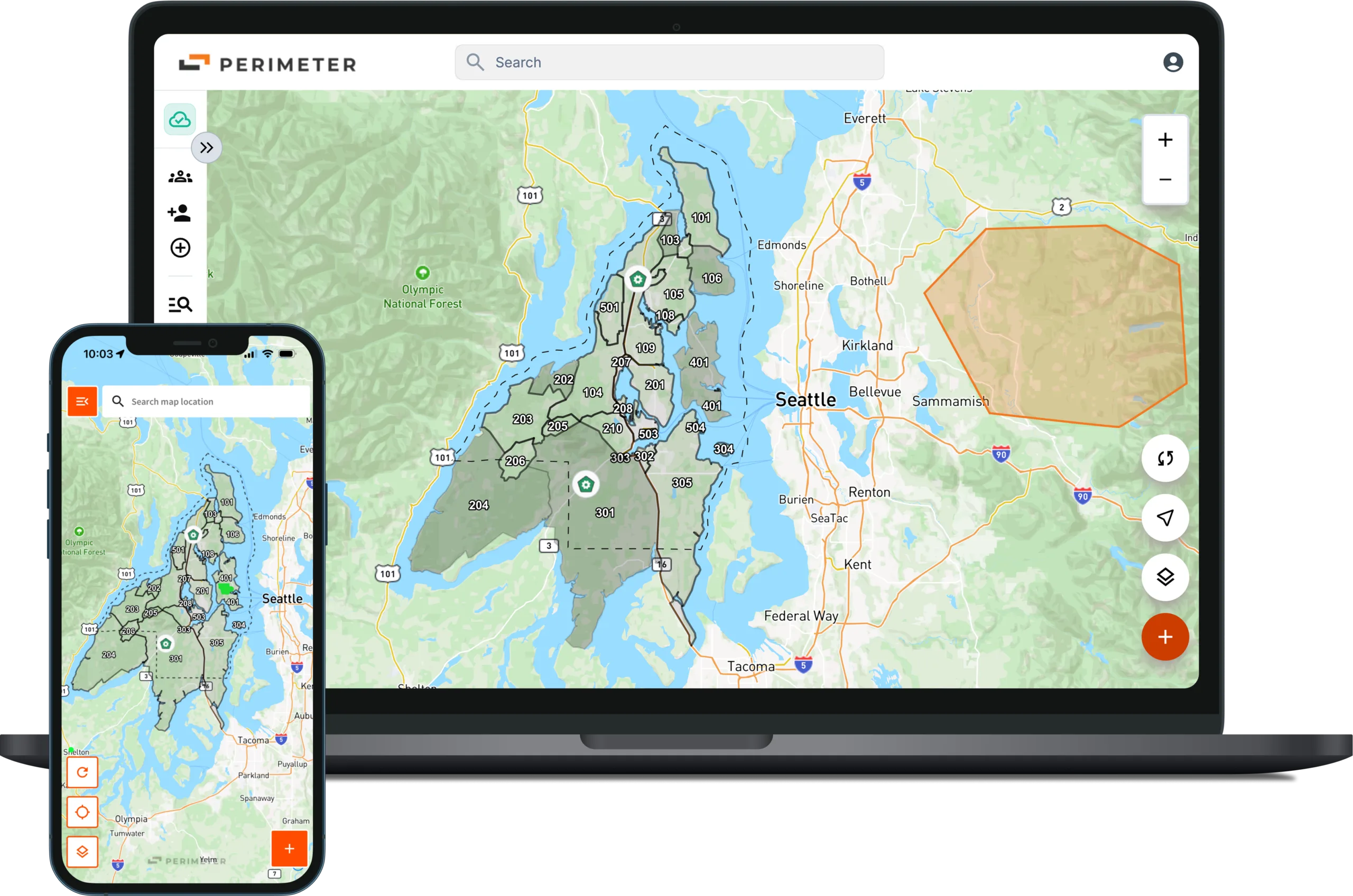


Features
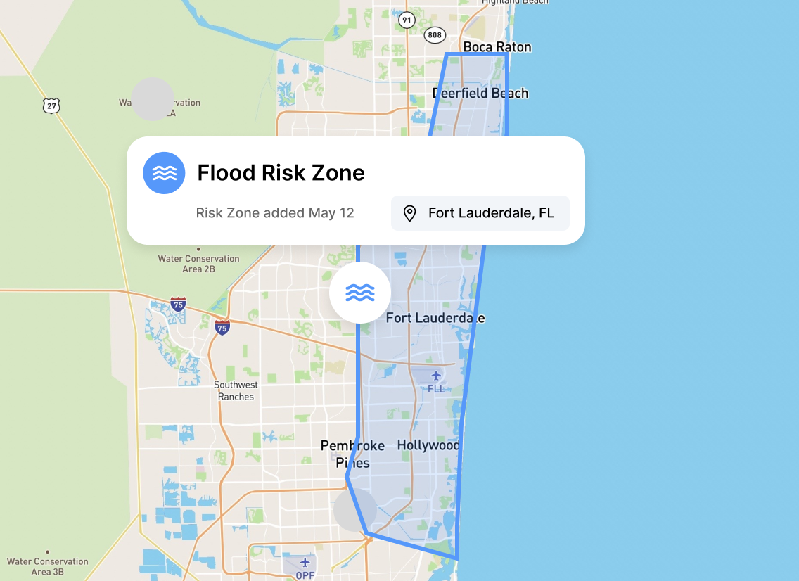
The real-time, collaborative map agencies use to create and share evacuation zones, closures, routes, and resources in seconds, then publish the exact same view to the public with a single link. No app, login, or registration required. It becomes your common operating picture for emergency management, fire, law, public works, and PIO teams, integrates with existing Esri data, and keeps an auditable record of every change. Communities using Perimeter get fewer non-emergency 911 calls because people can find answers fast, which helps build lasting public trust.

Integrations
It works with the tools public safety teams already use, so key information stays in one place. Perimeter pulls in data from multiple systems to create one shared, live map that agencies can edit together in real time. Share one simple public link, no login needed, through alerts, social, websites, or QR codes, so the public sees the same trusted updates. It works with Esri/ArcGIS, sends and receives data fast, and connects with alert tools like Everbridge. Export GeoJSON/KML for CodeRED, Rave, and CivicReady to keep alerts and visuals aligned. Admins control publishing, and every change is recorded. Built to work in low connectivity environments.

Use Cases
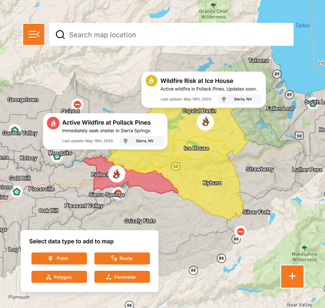
Used daily to give the community one view and one message. PIOs publish once and updates are automatically live, which has helped agencies cut 911 information calls by about 40 percent. Used for blue and gray-sky events such as parades, festivals, parking, utility work, street closures, school safety, and routine road incidents, as well as wildfires, floods, debris flows, hazmat, and other hazards. During major incidents, the link reaches residents fast and at scale; for example, a Washoe County wildfire incident reached 2.4 million visits in nine days. Because there’s no app or opt-in and the link can be placed in alerts, social posts, and websites, residents instantly see their location against evacuation zones, routes, closures, shelters, and more.
Perimeter Plan and Perimeter Map are built to complement each other. Plan zones, sequences, clearance timelines, and route deconfliction ahead of time. During an incident, your team activates the plan, updates closures and resources, and publishes the same authoritative map to the public with a single link. From planning, response, recovery, and after action analysis, keep everyone aligned from exercises to operations. The result is faster decisions, clearer communication, and a community that knows what to do.

Ready for Any Threat
Manage all hazards from wildfires and floods to hurricanes and active assailants. Don’t switch tools when the mission changes. Manage every incident on a single, unified platform.

Prevent Skill Fade
Don’t let the software sit gathering dust. Use Perimeter for 4th of July parades and marathons so your team is muscle-memory ready when the real disaster hits.

Zero Learning Curve
Most government software requires a PhD to operate. We don't. Your staff and volunteers will be up and running in 15 minutes. No multi-day seminars required.

Partners, Not Vendors
At Perimeter, you’re part of the family. Get 24/7/365 direct access to a US-based support team that understands the urgency of your mission, and stays with you long after the contract is signed.
"Perimeter has revolutionized our emergency communication system by providing an all-risk solution that enables efficient evacuation management, information sharing, and collaboration across different disciplines and jurisdictions."

Mary Campbell
Public Information Officer – Lodi, CA
"The Perimeter Platform was easy to learn and easy to use, and we were able to use Perimeter with our existing processes to provide immediate and up-to-date information about evacuation zones, hazardous and closed roads, and sandbag and shelter locations."

Aaron Rosenberg, Captain
Merced County Sheriff
"The problem is consistent, concise messaging. Other platforms have issues with this basic messaging feature. Perimeter offers a platform that allows the authorities to keep the messaging in real-time, with viable information, at a fraction of the cost."

Ryan Sommers, Fire Chief
North Lake Tahoe Protection District, NV
"Perimeter is a one stop shop for all the information the public needs during and emergency. You don’t have to sign up for it, it’s just a website you go to. It’s good for the community and you can do it from your phone in 60 seconds."

Troy Morton, Lieutenant OES Director
El Dorado County Sheriff’s Office, CA
Replace static PDF maps and radio chatter with a single, real-time operating picture that keeps everyone safe.
Request a Demo

