Contact Perimeter Support

Support Request

arrow

Use this form to get help with Perimeter Map or Perimeter Plan. It’s monitored by our operations team regularly.

arrow

Have a General Question? Visit our Contact Us Page.

arrow

Need a Demo? Visit our Request a Demo Page.

image_head

Submit a Support Request

    Name *

    Email *

    Mobile Number *

    Organization/Agency & Location *

    Which Product *

    Severity *

    Best Contact Method *

    Description *

    By clicking ‘Submit Request’, you agree to Perimeter’s terms and conditions and privacy policy.

    Trusted by public safety, relied on by communities

    company-logo company-logo company-logo company-logo company-logo
    company-logo company-logo company-logo
    company-logo company-logo company-logo company-logo company-logo
    company-logo company-logo
    company-logo company-logo
    company-logo company-logo company-logo company-logo company-logo
    company-logo company-logo company-logo
    company-logo company-logo company-logo company-logo company-logo
    company-logo company-logo
    company-logo company-logo
    company-logo company-logo company-logo company-logo company-logo
    company-logo company-logo company-logo
    company-logo company-logo company-logo company-logo company-logo
    company-logo company-logo
    company-logo company-logo

    Customer Testimonials

    "Perimeter has revolutionized our emergency communication system by providing an all-risk solution that enables efficient evacuation management, information sharing, and collaboration across different disciplines and jurisdictions."

    Mary Campbell

    Mary Campbell

    Public Information Officer – Lodi, CA

    "The Perimeter Platform was easy to learn and easy to use, and we were able to use Perimeter with our existing processes to provide immediate and up-to-date information about evacuation zones, hazardous and closed roads, and sandbag and shelter locations."

    Aaron Rosenberg, Captain

    Aaron Rosenberg, Captain

    Merced County Sheriff

    "The problem is consistent, concise messaging. Other platforms have issues with this basic messaging feature. Perimeter offers a platform that allows the authorities to keep the messaging in real-time, with viable information, at a fraction of the cost."

    Ryan Sommers, Fire Chief

    Ryan Sommers, Fire Chief

    North Lake Tahoe Protection District, NV

    "Perimeter is a one stop shop for all the information the public needs during and emergency. You don’t have to sign up for it, it’s just a website you go to. It’s good for the community and you can do it from your phone in 60 seconds."

    Troy Morton, Lieutenant OES Director

    Troy Morton, Lieutenant OES Director

    El Dorado County Sheriff’s Office, CA

    How Perimeter Works

    Pre-plan and create real-time information

    Zones

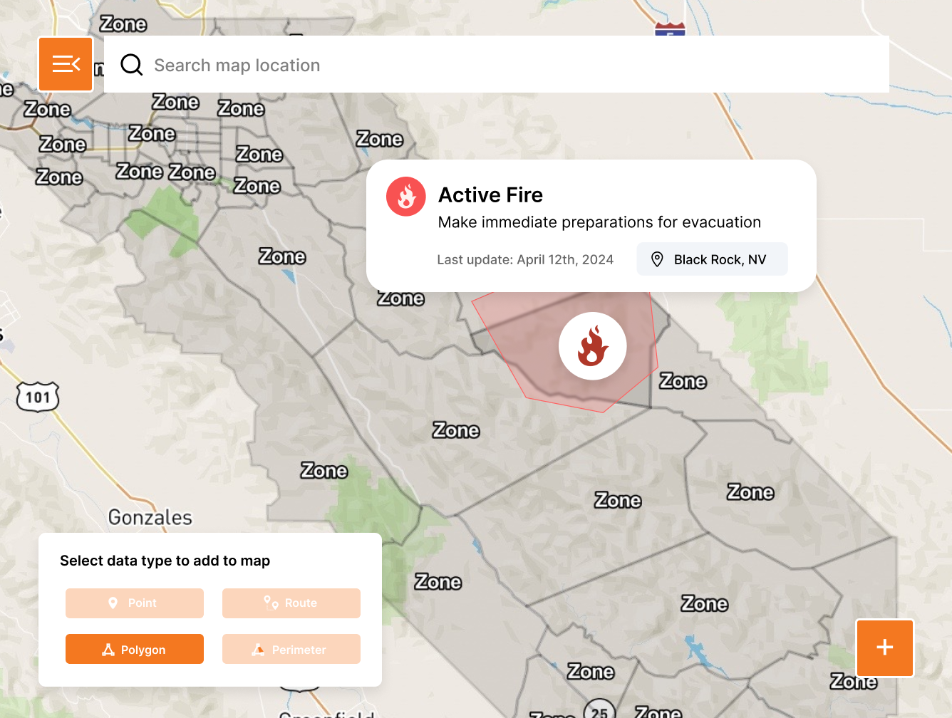
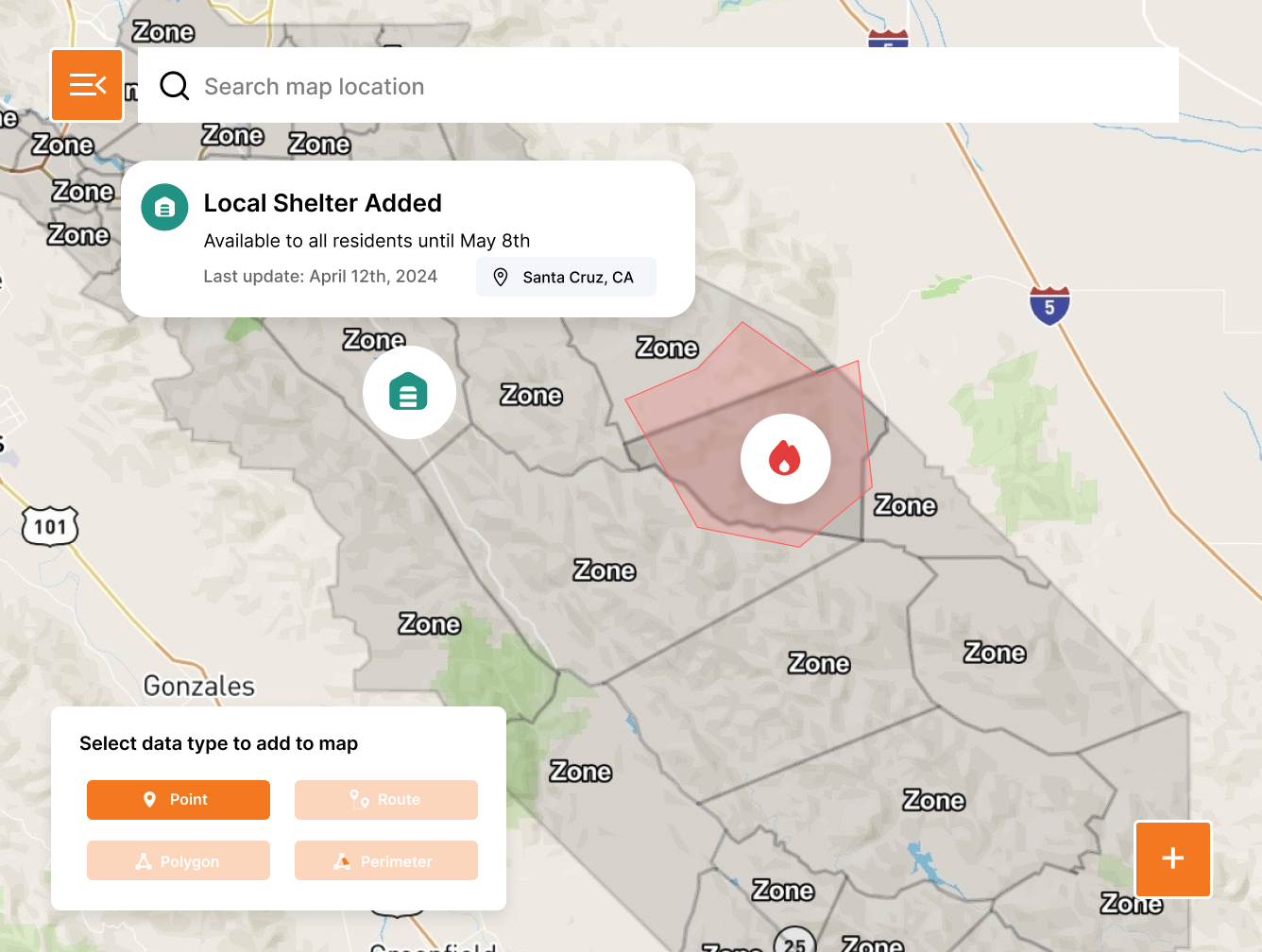
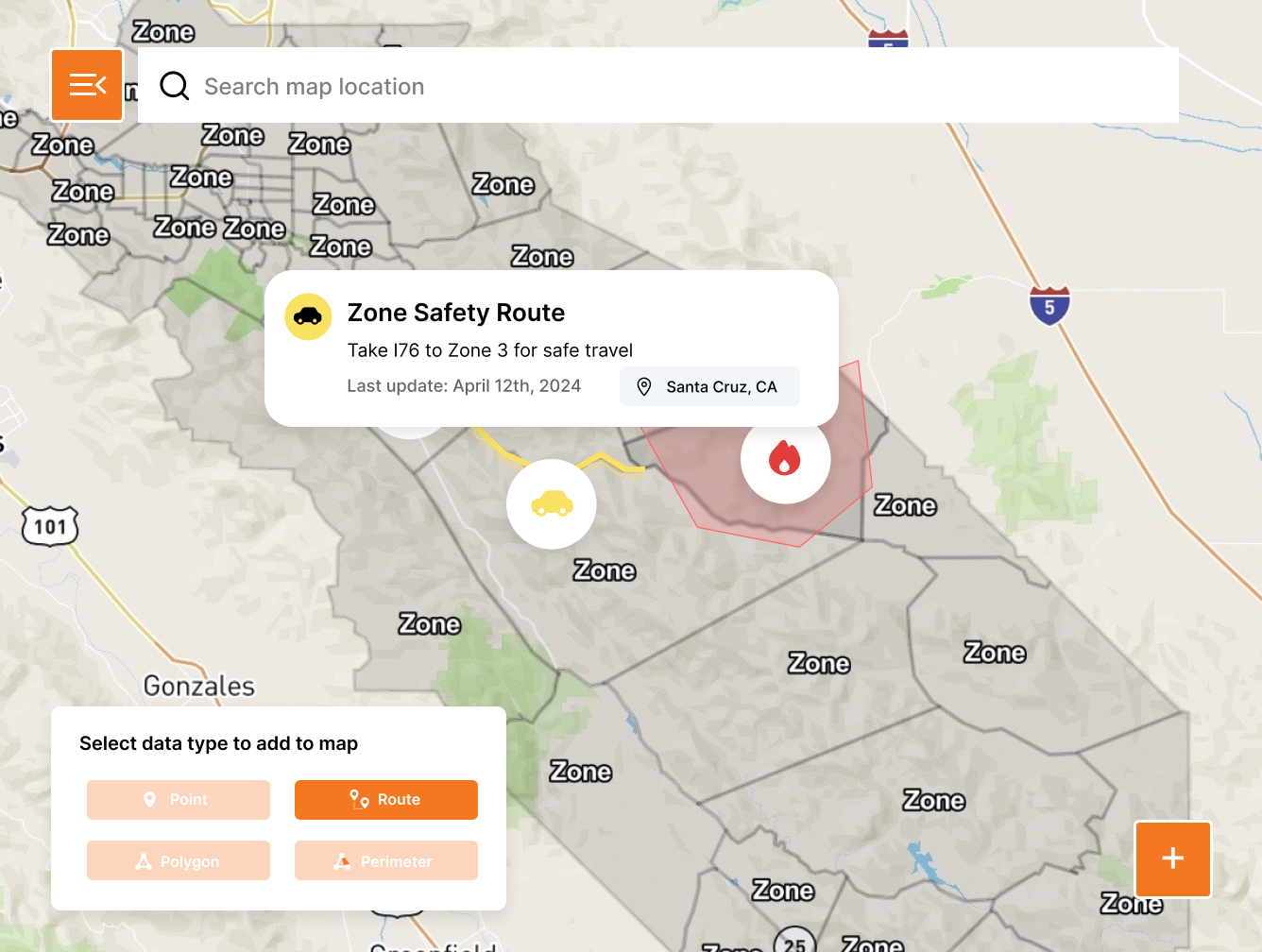
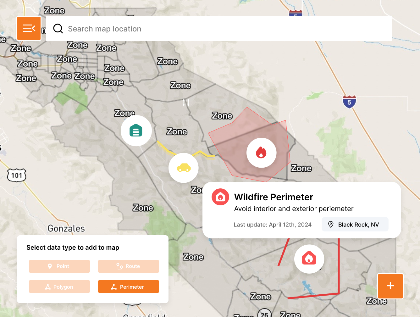
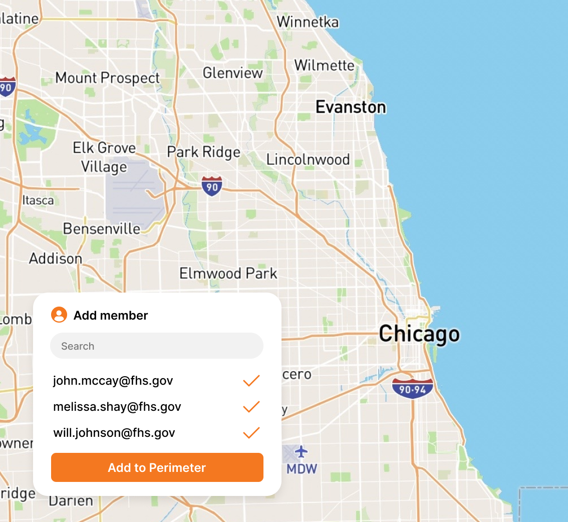
    Create pre-planned or ad hoc zones to ensure your residents and visitors have the best possible information.

    Points

    Points include shelters, road closures, resource distribution sites, hazards, at risk facilities, and other common information required during incidents.

    Routes

    Create preset or ad hoc routes to ensure that the citizens you serve have the best possible information.

    Perimeters

    Create open ended shapes to communicate the path of travel for events with unknown impacts.

    Request a Demo
    perimeter_works_image perimeter_works_image perimeter_works_image perimeter_works_image

    Perimeter Features

    The features you need to get started today and take action in real-time

    Request a Demo
    Quick & easy onboarding

    Quick & easy onboarding

    Get started in minutes, not days or weeks. Perimeter is the fastest and most intuitive solution available on the market.

    arrow

    15-minute setup

    arrow

    Custom map creation

    arrow

    On-going support

    Full team management

    Full team management

    Perimeter makes it easy to manage your teams, create administrators, and share information between agencies and jurisdictions.

    arrow

    Add/remove users

    arrow

    Set administrators

    arrow

    Shared information

    Seamless data integrations

    Seamless data integrations

    Easily access all data created in Perimeter to leverage across existing communication channels currently implemented in your org.

    arrow

    KML

    arrow

    GeoJSON

    arrow

    Esri

    Built for the reality of public safety.

    Ready for Any Threat

    Ready for Any Threat

    Manage all hazards from wildfires and floods to hurricanes and active assailants. Don’t switch tools when the mission changes. Manage every incident on a single, unified platform.

    Prevent Skill Fade

    Prevent Skill Fade

    Don’t let the software sit gathering dust. Use Perimeter for 4th of July parades and marathons so your team is muscle-memory ready when the real disaster hits.

    Zero Learning Curve

    Zero Learning Curve

    Most government software requires a PhD to operate. We don't. Your staff and volunteers will be up and running in 15 minutes. No multi-day seminars required.

    Partners, Not Vendors

    Partners, Not Vendors

    At Perimeter, you’re part of the family. Get 24/7/365 direct access to a US-based support team that understands the urgency of your mission, and stays with you long after the contract is signed.

    Deploy in minutes, not months.

    Your community is looking to you for answers. Are you ready?

    Replace static PDF maps and radio chatter with a single, real-time operating picture that keeps everyone safe.

    Request a Demo