

Replace static PDF maps and radio chatter with a single, real-time operating picture that keeps everyone safe.
Request a DemoRelease Notes: Perimeter Platform Update
 Perimeter Staff – December 1, 2025
The Perimeter team is constantly working to enhance our applications based on customer feedback and user experience. On December 2, 2025, we’ll be releasing a system wide update to the Perimeter Platform.
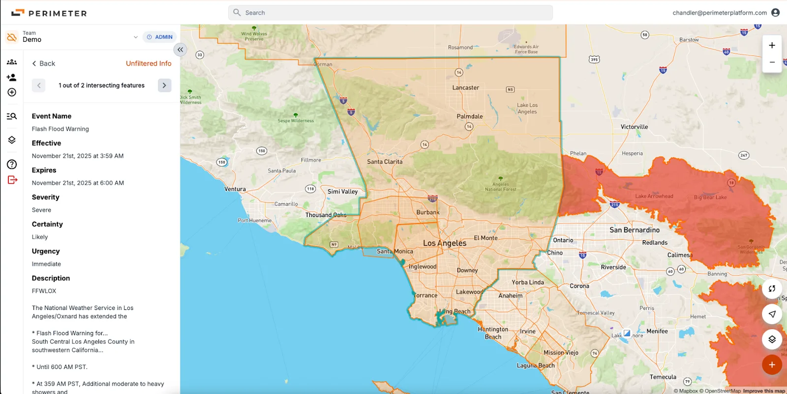
NOAA Weather Alerts – Internal Web, Mobile App
We’ve added real-time NOAA Weather Alerts to the Perimeter Map as a new visual data layer.
To reduce clutter and keep the map focused on essential operational information, Perimeter displays only high-severity alerts that pose a direct threat to life or property – including flood, fire, hurricane, earthquake and tornado warnings. If you have questions about the NOAA data layer that will be displayed, we will be happy to schedule a call to discuss the details.
The layer is enabled by default and can be turned on or off in Map Options.
This feature is launching as an internal release while we validate the experience. Once performance and usability are fully dialed in, we’ll extend these alerts to the public map.
Icon Reordering – Internal Web, Public Web, Mobile App
To improve ease of use and accessibility, we have sorted the list of icon types into category types: Most Used, Response Infrastructure, Hazards and General Infrastructure.
Base Map Update – Internal Web, Public Web (not mobile app)
The base street map has been updated to the latest version from Open Street Maps. This update includes additional building footprints, location labels and roadways.
As always, please contact Van Riviere at van@perimeterplatform.com or by phone at (209) 483-1513 if you have questions or encounter challenges of any kind.
Sincerely,
The Perimeter Team


