

Replace static PDF maps and radio chatter with a single, real-time operating picture that keeps everyone safe.
Request a DemoRelease Notes: Perimeter Internal Web App Update
 Perimeter Staff – June 1, 2026
We are constantly working to enhance our applications based on customer feedback and user experience. On Tuesday, June 2, 2026, we will release the following update to the Internal Web application.
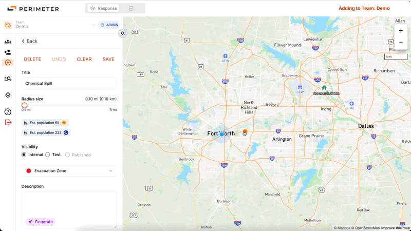
Radius Zones
Users can now quickly draw radius zones on the map. Radius zones can be exported as KML or Geojson files and uploaded directly into your mass notification platform. On Mobile, radius zones are viewable and editable as polygons. This feature will be added to Perimeter Mobile in the near future.
Data Sharing Between Teams
Teams can now view data shared from other teams. Shared data is read-only to prevent unintended edits and will display on web and mobile. Data sharing is set up by request only, please contact us if you would like data sharing set up between teams.
FIRIS Integration
We have integrated real time FIRIS fire perimeter polygons are now displayed on the map.
As always, please contact Van Riviere at van@perimeterplatform.com or by phone at (209) 483-1513 if you have questions or encounter challenges of any kind.
Sincerely,
The Perimeter Team


