Perimeter Staff – February 18, 2026
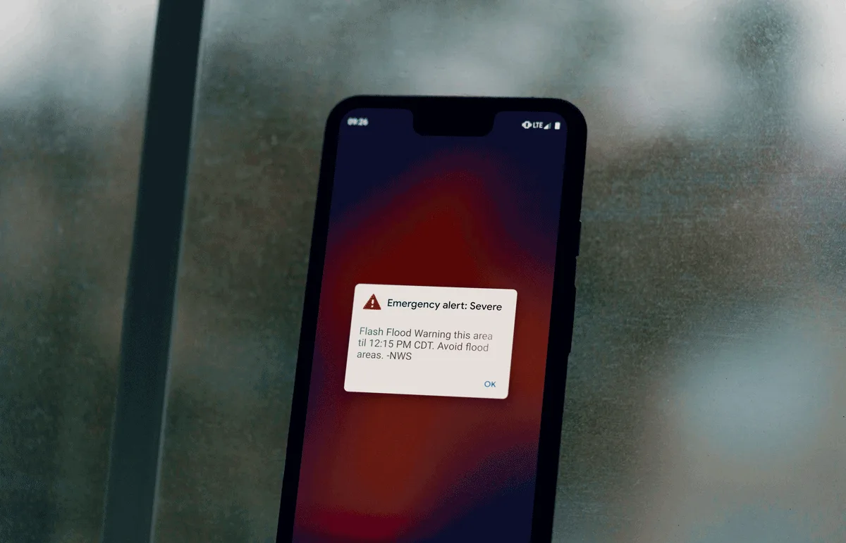
Emergency managers across the country are investing in mass notification alert systems, and they should be. But a growing body of research shows that alerts alone leave critical gaps in public awareness. Here’s what the data says, and what forward-thinking agencies are doing about it.
It’s 2 a.m. and a disaster threat is moving fast. The county emergency manager triggers a mass notification alert. Thousands of phones buzz with a 90-character message: “Disaster threat in your area. Evacuate immediately. Visit county website for info.”
But what happens next?
A family on the south side of town reads the alert and panics. Are they in the disaster zone, or three miles from it? A resident who never signed up for the county’s opt-in mass notification alert system sleeps through the night with no idea anything is happening. A Spanish-speaking household receives a message they can only partially understand. And a retired couple without smartphones waits for a knock on the door that may never come.
The alert was sent. But knowing what to do and where to go? That’s a different story entirely.
Now imagine the same scenario, but the alert reads differently:
“Evacuation order: Zone 4. Check zones and evacuation routes at perimetermap.com/yourcounty”
Same 90 characters. Same notification system. But now the resident has somewhere to go: a live map that shows their zone, their status, their route, and their nearest shelter, updated in real time as conditions change. That single link transforms a moment of confusion into a moment of clarity.
The Opt-In Problem: Who’s Actually Receiving Your Alerts?
Mass notification alert platforms are foundational to emergency communication. They save lives, and every agency should have one. But one of the most persistent challenges in emergency management is that opt-in notification systems only reach a fraction of the population.
As one public safety communications expert put it, roughly 40 percent of a community’s population can typically be reached when agencies import existing databases and residents voluntarily opt in to notification systems (GovTech, 2021). That means the majority of residents, the people who didn’t sign up, didn’t know the system existed, or moved into the area after the last enrollment push, may never receive a locally targeted mass notification alert.
Even the federal Wireless Emergency Alert (WEA) system, which doesn’t require opt-in and reaches most cell phones by default, has limitations. A 2024 national survey conducted by the RAND Corporation for FEMA found that approximately 17.5 percent of U.S. adults with working cell phones, roughly one in six, reported having opted out of at least one type of WEA alert. The report noted that “because the phone-to-human step is the last link in the chain of communication, opting out represents a key limitation of WEA’s capacity to alert the public” (Parker et al., 2024).
The FCC took note. In March 2025, the Commission opened a formal rulemaking proceeding to explore ways to reduce WEA opt-out rates, including giving alert originators more flexibility in how messages are presented and exploring whether subscribers should have additional customization options (FCC, 2025).
The bottom line: even the most robust alert system has blind spots. And those blind spots tend to disproportionately affect the people who need help the most: elderly residents, non-English speakers, transient populations, and those without reliable access to technology.
An Alert Tells You What. It Doesn’t Tell You Where or What To Do.
Receiving an alert is only the first step in a chain of decisions that determines whether someone takes protective action. And the research is clear: text-based messages alone often aren’t enough to drive that action.
A peer-reviewed study by Kim et al. (2019), published in the Journal of Contingencies and Crisis Management, found that only about one in five participants took immediate protective action after receiving a text-based wireless emergency mass notification alert. The study found that whether someone acts depends heavily on whether they believe the message, whether they can personalize the threat to their own situation, and whether they can find environmental or social cues to confirm the danger.
This finding is consistent with decades of research grounded in the Protective Action Decision Model (PADM), developed by Lindell and Perry (2012), which demonstrates that people don’t simply receive a warning and act. They go through a cognitive process: Do I believe this? Does this apply to me? What should I do? Can I do it? When a 90-character text message is the only information available, many people stall at step two.
FEMA’s own 2021 research report, Improving Public Messaging for Evacuation and Shelter-in-Place, reviewed over 120 peer-reviewed articles and confirmed this. The report found that effective emergency messaging must help individuals understand not just that a threat exists, but whether it affects them personally, what specific action to take, and how to take it. The study recommended that emergency managers provide multiple ways for residents to corroborate warnings and access geographically specific information (FEMA / Argonne National Laboratory, 2021).
A comprehensive literature review published in Natural Hazards (2023) reinforced this point, noting that researchers have consistently highlighted the positive impact of providing geographic awareness and impact-area maps as part of public alert and warning messages. The review also found that generic location language, such as “in this area,” was often not specific enough to prompt people to take protective action (Aboelata et al., 2023).
In other words: people need to see where they are in relation to the threat. A map does what a text message cannot. It answers the two questions every resident asks first: “Does this affect me? Am I Safe?”
When a community has pre-built evacuation zones that residents can look up by address, before, during, or after an alert, the gap between receiving a warning and understanding what it means shrinks dramatically. The alert becomes the trigger. The map becomes the plan.
Information Changes Faster Than Alerts Can Keep Up
Even when alerts reach the right people with the right message, emergencies are dynamic. Road closures shift. Evacuation zones expand. Shelters fill up and new ones open. The information that was accurate at 2 a.m. may be dangerously outdated by 4 a.m.
As one county emergency management director described it during a recent conversation with public safety professionals: “As that situation changes, we can post this roadway is closed. But 30 minutes later, that street could become a problem. And if people are still looking at the original post…”
Social media compounds this challenge. While platforms like Facebook and Nextdoor are valuable for reaching large audiences, they are inherently static. A post made at midnight sits unchanged even as conditions evolve. And when the power goes out, connectivity drops, and misinformation begins to fill the void.
Another emergency management professional put it bluntly: “Once electricity went out, we have no connection to anywhere, anybody. We couldn’t contact family. Family couldn’t contact emergency services.”
The challenge isn’t just reaching people with the initial alert. It’s keeping them informed as the situation evolves, in real time, without requiring them to refresh a page, check a new post, or call 911 for an update. Agencies that can point the public to a single, living source of truth, a map that updates as the incident unfolds, reduce the burden on dispatch centers, PIOs, and social media teams, all while giving residents exactly what they need: current information tied to their location.
What a More Complete Communication Strategy Looks Like
None of this means mass notification alerts aren’t essential because they absolutely are. Opt-in mass notification alert platforms, WEA, IPAWS, sirens, and social media all play critical roles. The question isn’t whether to use them. It’s whether they’re enough on their own.
The research consistently points in the same direction: the most effective emergency communication strategies layer multiple channels and formats, including visual, geographic, and real-time information that helps people understand the threat in the context of their own location.
The peer-reviewed literature increasingly supports the value of map-based and visual communication during emergencies. Studies have shown that visual display information, such as maps, wayfinding graphics, and geographic context, can meaningfully reduce response times compared to auditory alarms alone (Proulx & Sime, 1991; Samochine et al., 2005). Research in GIS and emergency management has shown that geographic information systems allow agencies to overlay real-time data, from road closures to hazard perimeters to shelter locations, in ways that support faster, more informed decision-making for both responders and the public.
Agencies that pair their notification platforms with live, public-facing maps are closing the gap between alert and action. They’re giving residents a way to answer the critical questions that a text message alone can’t: Am I in the zone? Which way should I go? Where is the shelter? Is my route still open?
And because these maps don’t require opt-in, anyone with a link can access them, they reach the populations that traditional notification systems miss: tourists, commuters, non-English speakers who can interpret a visual map more easily than a text alert, and residents who simply never signed up.
This is also why the link in the alert matters so much. When an agency’s notification message includes a URL to a live, public-facing map, not a static PDF, not a county homepage, but a real-time visual that shows zone status, road closures, shelter locations, and evacuation routes, it turns every mass notification alert platform into something more powerful than it was designed to be. The notification system provides the reach. The map provides the understanding.
The Heroes Closing This Gap
Across the country, emergency managers, PIOs, fire chiefs, and GIS analysts are recognizing this gap and building more complete communication strategies. They’re not abandoning their alert systems. They’re enhancing them. They’re combining the speed of mass notification alerts with the clarity of visual, geographic information to give their communities something a text alert alone can never provide: a real-time picture of what’s happening and what to do about it.
That’s not a technology problem. That’s leadership. And it’s happening in counties and agencies of every size, in every region of the country.
The alert gets attention. The map drives action.
Want to learn how agencies across the country are building more complete emergency communication strategies? Visit perimeterplatform.com to see how map-based communication complements your existing tools.
References
Parker, A.M., Steratore, R., Bradley, M.A., et al. (2024). Assessing Public Reach of the 2023 National Test of the Wireless Emergency Alerts (WEA) System: Results of a National Survey. RAND Corporation, RR-A2451-1. rand.org
Kim, G., Martel, A., Eisenman, D., Prelip, M., Arevian, A., Johnson, K.L., & Glik, D. (2019). “Wireless Emergency Alert messages: Influences on protective action behaviour.” Journal of Contingencies and Crisis Management, 27(4), 374–386.
Lindell, M.K. & Perry, R.W. (2012). “The Protective Action Decision Model: Theoretical Modifications and Additional Evidence.” Risk Analysis, 32(4), 616–632.
Federal Emergency Management Agency (FEMA) / Argonne National Laboratory. (2021). Improving Public Messaging for Evacuation and Shelter-in-Place: Literature Review Report. fema.gov
Sutton, J. & Wood, M.M. (2025). “Opting Out: Over-Alerting and Warning Fatigue in the Era of Wireless Emergency Alerts.” Journal of Contingencies and Crisis Management, 33(3), e70076.
Federal Communications Commission (FCC). (2025). Wireless Emergency Alerts; Emergency Alert System: Notice of Proposed Rulemaking. PS Docket Nos. 15-91 and 15-94. federalregister.gov
Aboelata, M., et al. (2023). “Public alert and warning system literature review in the USA: identifying research gaps and lessons for practice.” Natural Hazards, 118, 1–34. PMC
Proulx, G. & Sime, J.D. (1991). “To prevent ‘panic’ in an underground emergency: Why not tell people the truth?” Fire Safety Science: Proceedings of the Third International Symposium, 843–852.
Strait, R. (2021). “How to Properly Manage the Power and Reach of Your Mass Notification System.” GovTech. govtech.com
Fischhoff, B., Gonzalez, R.M., Small, D.A., & Lerner, J.S. (2006). “Predicting Emergency Evacuation and Sheltering Behavior: A Structured Analytical Approach.” Risk Analysis, 27(6), 1459–1471.