

Replace static PDF maps and radio chatter with a single, real-time operating picture that keeps everyone safe.
Request a DemoRelease Notes: Perimeter Platform Update – Wednesday, October 14, 2026
 Perimeter Staff – October 13, 2026
Internal Web Update v26.10.0
Perimeter Administrators and Stakeholders:
Tomorrow we’re releasing two significant updates to Perimeter Map that will improve situational awareness and response efficiency.
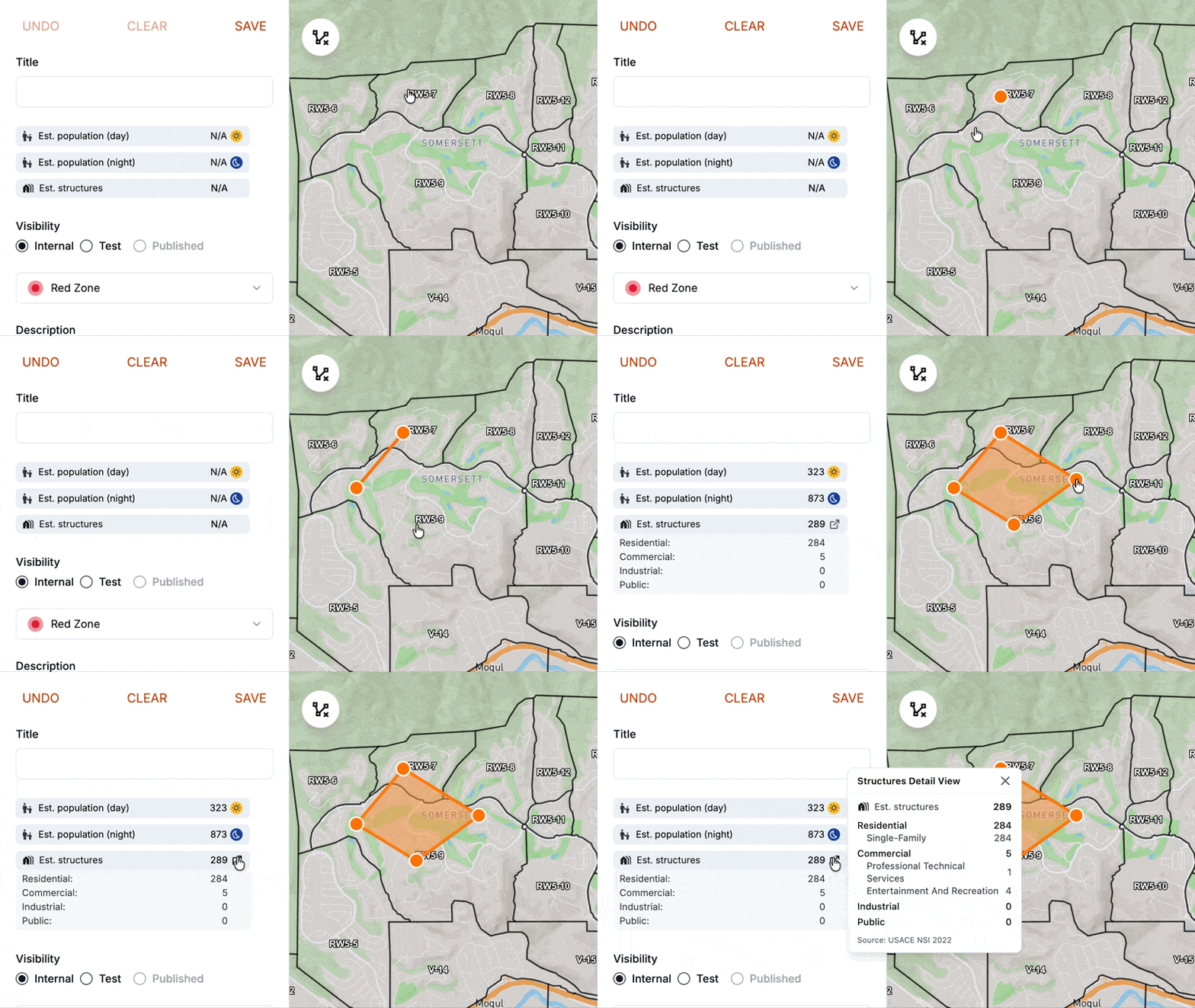
Structure counts, built into the map
Draw or select a polygon to see an estimated structure count, broken out into Residential, Commercial, Industrial, and Public. Click the summary for a detailed breakdown, or select multiple zones for a combined total.
Paired with the population estimates already in Perimeter, you can now immediately calculate how many people and structures are impacted.
How teams use it
- Early incident reporting: Get structure counts for threatened areas in the first hours of an incident, when initial estimates are needed to support information requests.
- Identifying at-risk areas: Zones with multi-family housing, nursing homes, or hospitals have different evacuation needs than zones that are mostly commercial or industrial.
- Briefing leadership: Select every active zone for combined population and structure totals, ready to drop into a situation report.
About the data: Structure data comes from USACE National Structure Inventory (2022) and may undercount areas with recent development. Perimeter is continually evaluating new data sources to supplement this as our platform evolves.
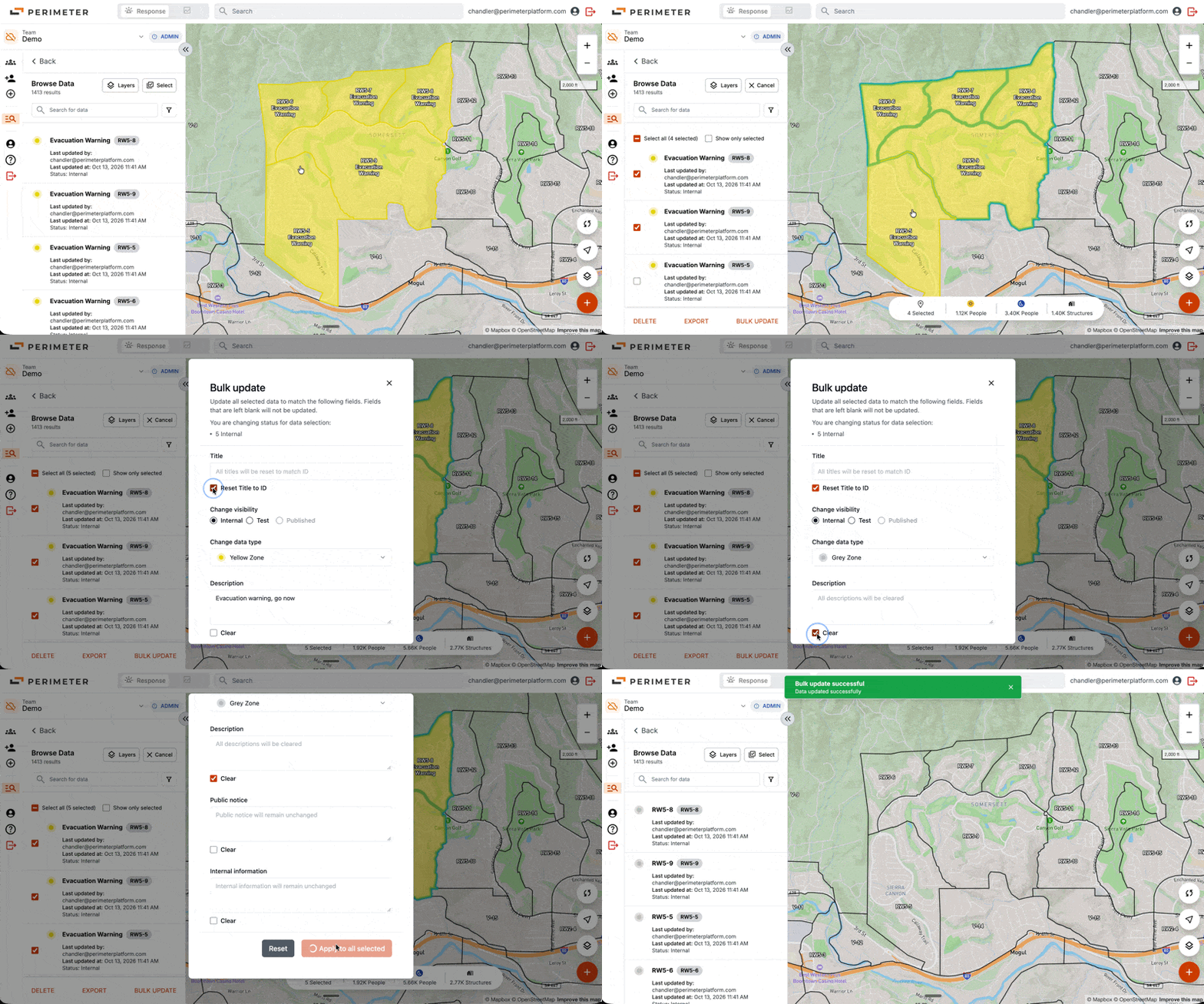
Update every field at once
During an incident, conditions can change across many zones at once. Before this update, making those changes meant opening and editing each zone individually.
Bulk update now covers every field: title, description, public notice, and internal information. Select any data, change a field once, and the change applies to all of them. Combine this with the new quick select feature (Hold ⌘ + click on Mac or Ctrl + click on Windows) and reduce update time to minutes. This expansion came directly from customer feedback.
Questions or feedback? Email chandler@perimeterplatform.com.
Need support? Contact support@perimeterplatform.com.


