Perimeter Staff – September 10, 2024
Outdated technology systems, broken communication channels and information overload in a maximum stress environment — this is the harsh reality for emergency response crews.
The world of a first responder is extremely high stakes — where every second counts, lives are on the line, and there’s zero room for mistakes. That means even the smallest inefficiency can yield devastating consequences.
There has to be a better way — and there is.
Imagine a world where your teams are well-coordinated, critical information is readily available, and your response to any disaster event is flawless.
This is the power of modern day first responder software.
In this buyer’s guide, you’ll learn how it all works, the different types of solutions available on the market, and the essential features needed for managing crises.
What is First Responder Software?
First responder software is software designed to help emergency services personnel, such as police, firefighters, and paramedics, respond to incidents more efficiently and effectively. It streamlines communication, enhances situational awareness, and optimizes resource management during critical incidents.
Think of it as a central hub where all the information, tools, and communication channels converge to facilitate a rapid, coordinated, and effective response.
Main Types of First Responder
First responder software encompasses a wide array of tools designed to support different aspects of emergency response. Here’s a breakdown of the main types:
Computer-Aided Dispatch (CAD)
- This is the backbone of many emergency response systems.
- It automates call-taking, prioritizes incidents, assigns resources, and tracks responder locations.
- CAD systems provide real-time updates and improve communication between dispatchers and responders.
Records Management Systems (RMS)
- These systems store and manage incident reports, arrest records, field interviews, and other mission-critical data.
- They enable easy access to historical information, facilitate data analysis, and help with report generation.
- RMS software can be integrated with CAD systems for seamless real-time information flow.
Mobile Data Terminals (MDTs)
- MDTs are in-vehicle computers or tablets that give responders access to critical information while on the move.
- They provide real-time access to dispatch information, maps, routing, and communication tools.
- MDTs can also be used for report writing and data entry in the field.
Situational Awareness Platforms
- These platforms gather and integrate data from various sources like cameras, sensors, social media, and drones to provide a real-time view of an incident scene.
- They help responders assess risks, identify hazards, and make informed decisions based on a comprehensive understanding of the situation.
Firefighting Software
- Specialized software for fire departments includes tools for pre-incident planning, fire modeling, hydrant location, water supply calculations, and incident command support.
- It helps firefighters plan and execute their response strategies effectively.
EMS (Emergency Medical Services) Software
- This software is tailored to the needs of EMS agencies, paramedics and EMTs.
- It includes features like electronic patient care reporting (ePCR), medical protocols, drug references, and billing tools.
- EMS software streamlines patient care documentation and improves the efficiency of medical response.
Law Enforcement Software
- This category includes tools for case management, evidence tracking, crime analysis, suspect identification, and gang intelligence.
- Law enforcement software helps investigators connect the dots, identify patterns, and solve crimes more effectively.
Crisis Management Software
- Crisis management and crisis communication software are designed to help manage large-scale emergencies or disasters.
- They provide tools for communication, resource allocation, incident tracking, and public information dissemination.
- Crisis management software helps coordinate the response of multiple agencies and organizations during critical situations.
Additionally, some software solutions cater to specific needs, such as:
- 911 call-taking software
- Hazardous materials management software
- Search and rescue software
- Volunteer management software
Key Features for First Responder Software
When choosing first responder software, it’s crucial to consider the following top features to ensure it meets your agency’s specific needs and enhances your emergency response capabilities:
Intuitive Interface and Ease of Use
- User-friendly design with clear navigation and easy-to-understand icons and functions.
- Minimal training required for new users to get up to speed quickly.
- Customizable dashboards and workflows to tailor the software to your specific needs.
Robust Incident Management
- Real-time incident tracking and logging with detailed information (location, type, resources deployed, etc.).
- Automated dispatching and resource allocation based on pre-defined protocols.
- Customizable status updates and incident timelines for improved situational awareness.
- Seamless integration with CAD (Computer-Aided Dispatch) systems.
Effective Communication and Collaboration Tools
- Secure and reliable messaging and voice communication channels.
- Real-time location sharing and tracking for improved coordination.
- Ability to share real-time information (maps, images, documents) between responders and agencies.
- Integration with existing communication systems (radios, phones, etc.).
Comprehensive Data Access and Visualization
- Interactive maps with real-time incident overlays and routing capabilities.
- Access to critical data such as building plans, hazardous material information, and medical records.
- Ability to visualize and analyze incident data for improved decision-making.
- Integration with GIS (Geographic Information System) platforms.
Mobile-First Design
- Native mobile applications for iOS and Android and Windows devices.
- Offline functionality for use in areas with limited connectivity.
- Optimized for smaller screens and touch-based interactions.
Scalability and Flexibility
- Ability to scale and meet the needs of small and large agencies.
- Customizable to fit your specific workflows and processes.
- Cloud hosted for resilience and scalability.
- Simple, reliable integration with other solutions and platforms.
Data Security and Privacy
- Industry standard security to protect sensitive data (patient information, incident details, etc.).
- Compliance with relevant data protection regulations (GDPR, HIPAA, PII, etc.).
- Regular security audits and updates to address vulnerabilities.
Training and Support
- Comprehensive training resources (user guides, tutorials, videos) for new users.
- Responsive customer support with multiple channels (phone, email, chat).
- Regular software updates to add new features and address issues.
Analytics and Reporting
- Customizable reports on incident response times, resource utilization, and other key metrics.
- Data analysis tools to identify trends and patterns for continuous improvement.
Affordability and Value
- Transparent pricing model with no hidden costs.
- Cost-effective solution that provides a positive return on investment.
10 Best First Responder Software on the Market Right Now
1. Perimeter
Perimeter is a cloud-based software specifically designed for public safety agencies to manage evacuations and streamline communication during crises as well as day to day operations.. It prioritizes interagency collaboration, real-time public communication, and accessibility of critical information. Perimeter aims to empower emergency responders and enhance community preparedness and response by addressing the limitations of traditional systems and reducing the time it takes to disseminate vital information.
Top Features
- Interagency Collaboration: Facilitates seamless coordination among fire departments, law enforcement, emergency management agencies, and allied agencies across jurisdictional boundaries.
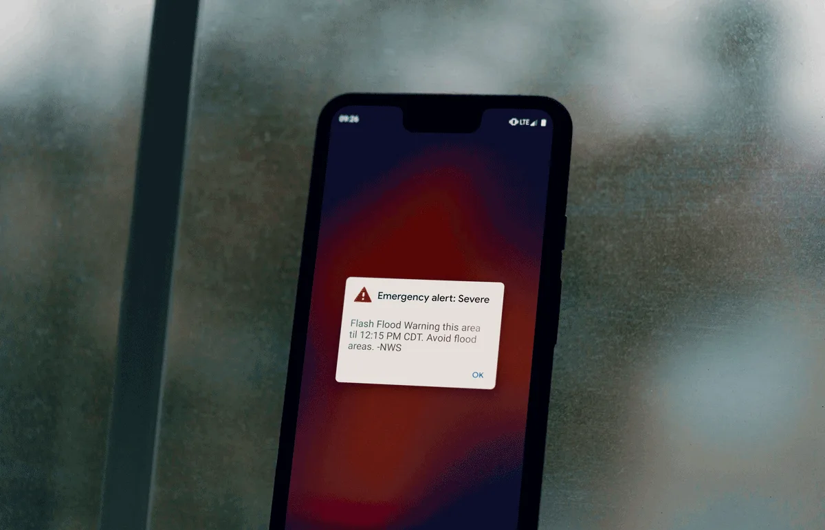
- Real-time Public Communication: Delivers real-time evacuation updates and critical information to the public via an intuitive, mobile-friendly interface, ensuring timely and transparent communication with residents and news outlets.
- Enhanced Accessibility: Eliminates barriers to access by removing the need for prior opt-ins, addressing language barriers, and providing visual guides. Ensures information and services are available to all users, regardless of their prior engagement or device preference.
- Time Efficiency: Streamlines information sharing, potentially saving up to 12 hours compared to traditional methods. This allows for faster emergency response and timely updates, reducing the impact of disasters.
- Usability: Prioritizes a user-friendly platform optimized for mobile devices with offline capabilities, enabling emergency managers to utilize the system efficiently without GIS expertise.
Pros
- Improved Interagency Collaboration: Breaks down silos between agencies, enabling smooth coordination and faster decision-making.
- Enhanced Public Communication: Reaches a broader audience in real-time, fostering trust and improving community preparedness.
- Increased Accessibility: Ensures critical information is available to everyone, including those with limited access to technology or language barriers.
Top Use Cases
- Emergency Management Agencies: Streamlines evacuation management and interagency collaboration during crises.
- Multi-Jurisdictional Regions: Facilitates coordination among various agencies from different counties responding to emergencies.
- Areas Prone to Natural Disasters: Provides efficient communication and preparedness resources for regions frequently facing evacuations.
Overall, Perimeter is a valuable asset for public safety agencies looking to optimize their emergency response capabilities, particularly in the areas of evacuation management and crisis communication. Its emphasis on collaboration, accessibility, and time efficiency can make a significant difference in saving lives and minimizing the impact of disasters.
2. Responder360
Responder360 is a comprehensive incident response system designed for first responders. Its primary focus is to provide real-time situational awareness and data access during emergencies, empowering responders with the information they need to make faster, safer, and more informed decisions. It seamlessly integrates with CAD systems and offers a user-friendly interface accessible on any device, making it an essential tool for modern emergency response.
Top Features
- Real-time Vehicle Tracking: Monitor the location and status of all responding units on an interactive map.
- Incident Data Viewing: Access detailed incident information, including dispatch notes, call history, and hazard data.
- Pre-Plan Access: View NFPA-compliant pre-plans directly on the map, providing critical building information.
- Hydrant Location and Water Supply Data: Quickly locate hydrants and access water supply information for firefighting operations.
- CAD Integration: Seamlessly integrates with Computer-Aided Dispatch systems for streamlined communication and data sharing.
- Customizable Map Layers: Overlay various data layers (e.g., zoning, infrastructure, weather) for enhanced situational awareness.
- Offline Mode: Access pre-downloaded maps and data even when internet connectivity is unavailable.
- Cloud-Based Platform: Accessible from any device with an internet connection, ensuring flexibility and convenience.
Pros
- Enhances Situational Awareness: Provides a comprehensive view of the incident scene, enabling faster and more informed decision-making.
- Improves Communication and Coordination: Facilitates seamless communication and data sharing between responders and dispatchers.
- Increases Efficiency and Safety: Streamlines response operations, optimizes resource allocation, and enhances responder safety.
Cons
- Learning Curve: Some users may require initial training to fully utilize all the features and capabilities.
- Internet Dependency: While offline mode is available, optimal functionality requires a reliable internet connection.
- No Public-Facing Functionality: This software is used for internal communications, not sharing information with the public. Agencies may need to explore additional solutions for public communications, or dedicate additional time during an incident to ensure data is consistent across all tools.
3. Focus FS
Focus FS is a comprehensive safety software platform designed for industrial worksites. Its primary focus is to improve workplace safety through streamlined incident management, asset safety, and team safety. It aims to create a safer work environment by ensuring compliance, optimizing operations, and enabling efficient emergency response.
Top Features
- Incident Reporting and Management: Simplified reporting process with customizable forms, automated workflows, and analytics for insights.
- Asset Management: Streamlined inspection and maintenance processes, real-time tracking of equipment location and status, and automated crib management.
- Team Safety: Centralized tracking of training and certifications, streamlined HSE reporting and action management, and enhanced investigation capabilities.
- Emergency Response: Preparation and response tools for severe weather events and other emergencies, with communication and reporting capabilities.
- Data Analytics and Reporting: Customizable dashboards and reports to track safety performance, identify trends, and improve decision-making.
Pros
- Comprehensive Safety Solution: Covers various aspects of workplace safety, from incident management to asset and team safety.
- Customizable and Scalable: Adapts to the specific needs of different industries and organizations.
- User-Friendly Interface: Intuitive design and easy navigation for efficient use.
Cons
- Implementation Time: May require initial time investment for setup and customization.
- Mobile App Functionality: While accessible on mobile devices, some features may be optimized for desktop use.
- No Public-Facing Functionality: This software is used for internal communications, not sharing information with the public. Agencies may need to explore additional solutions for public communications, or dedicate additional time during an incident to ensure data is consistent across all tools.
4. PowerDMS
PowerDMS is a policy and training management platform designed for first responders and other organizations. Its primary focus is to streamline policy management, ensure compliance, and facilitate personnel training. By centralizing and automating critical processes, it aims to create a more efficient and accountable workforce.
Top Features
- Policy Management: Centralized repository for policies and procedures, version control, automated workflows, and easy access for employees.
- Training Management: Online training modules, quizzes, certifications, and tracking of employee progress and compliance.
- Accreditation Management: Streamlined process for managing accreditation requirements, documentation, and reporting.
- Document Management: Secure storage, organization, and sharing of documents, with version control and audit trails.
- Reporting and Analytics: Custom reports on policy compliance, training completion, and other key metrics for data-driven decision-making.
Pros
- Streamlined Policy Management: Simplifies policy creation, distribution, review, and updates, ensuring everyone has access to the latest information.
- Enhanced Compliance: Automated workflows and tracking help ensure adherence to policies and procedures, reducing risk.
- Centralized Training: Provides a convenient platform for online training, testing, and certification, improving employee knowledge and skills.
Cons
- Learning Curve: Some users may require initial training to fully utilize all the features.
- Limited Customization: While customizable to some extent, it may not be as flexible as other solutions in tailoring to specific workflows.
- No Public-Facing Functionality: This software is used for internal communications, not sharing information with the public. Agencies may need to explore additional solutions for public communications, or dedicate additional time during an incident to ensure data is consistent across all tools.
5. Adashi FirstResponse MDT
Adashi FirstResponse MDT is an enterprise-level mobile data terminal (MDT) software designed for first responders. Its primary focus is to provide responders with real-time access to critical information and communication tools, directly in their vehicles. This enhances situational awareness, improves decision-making, and enables faster, more effective responses to emergencies.
Top Features
- Incident Notification: Instantaneously notifies responders with detailed dispatch information and turn-by-turn directions.
- Custom Map Layers: Integrates with various mapping platforms and allows for the creation of custom map layers with relevant information.
- RMS Integration: Interfaces with public safety Records Management Systems (RMS) to access pre-plan information, including building layouts, hydrants, and hazards.
- Turn-by-Turn Navigation: Provides turn-by-turn navigation to incident locations, ensuring responders arrive quickly and safely.
- Messaging and Status Updates: Enables real-time communication with dispatch and other responders, updating status and sharing critical information.
- Intuitive Interface: User-friendly interface designed for easy access and use while on the move.
Pros
- Enhanced Situational Awareness: Provides responders with a comprehensive view of the incident scene before arrival.
- Improved Communication: Facilitates real-time communication between responders and dispatch, enhancing coordination.
- Streamlined Workflow: Simplifies access to critical information, saving time and improving efficiency.
Cons
- Learning Curve: May require initial training for optimal use of all features.
- Hardware Requirements: Requires compatible mobile data terminals for full functionality.
- No Public-Facing Functionality: This software is used for internal communications, not sharing information with the public. Agencies may need to explore additional solutions for public communications, or dedicate additional time during an incident to ensure data is consistent across all tools.
6. nFocus GeoSuite
nFocus GeoSuite is a web-based emergency response software designed to provide real-time data and communication tools for command staff and responders in the field. Its primary focus is to enhance situational awareness, facilitate collaboration, and improve decision-making during emergencies.
Top Features
- Real-time Incident Mapping: Displays incident locations, responding units, and other critical information on a map.
- Resource Tracking: Tracks the location and status of personnel and resources, enabling efficient deployment and management.
- Communication Tools: Facilitates communication between responders, dispatchers, and command staff through messaging, voice, and video.
- Customizable Dashboards: Provides a user-friendly interface with customizable dashboards to display relevant information for different roles.
- Data Analytics: Captures and analyzes incident data to identify trends, improve response strategies, and optimize resource allocation.
Pros
- Web-Based Platform: Accessible from any device with an internet connection, offering flexibility and convenience.
- Real-time Data: Provides up-to-the-minute information for improved situational awareness and decision-making.
- Scalable and Customizable: Adaptable to the needs of different agencies and emergency situations.
Cons
- Internet Dependency: Requires a reliable internet connection for full functionality.
- Complexity: May require initial training and configuration to fully utilize the system’s capabilities.
- No Public-Facing Functionality: This software is used for internal communications, not sharing information with the public. Agencies may need to explore additional solutions for public communications, or dedicate additional time during an incident to ensure data is consistent across all tools.
7. ArcGIS Emergency Management Operations by ESRI
ArcGIS Emergency Management Operations is a comprehensive geospatial platform designed for emergency management agencies. Its primary focus is to provide a centralized system for real-time situational awareness, incident analysis, and resource management during emergencies and disasters. By leveraging geographic information system (GIS) technology, it enables better decision-making, communication, and coordination for effective response and recovery efforts.
Top Features
- Situational Awareness: Real-time mapping of incidents, resources, and personnel, providing a shared operational picture.
- Incident Analysis: Tools for assessing the impact of incidents, identifying vulnerable populations, and planning response strategies.
- Damage Assessment: Mobile app for rapid damage assessment in the field, with data synced to the platform for analysis.
- Resource Management: Tracking of resources, personnel, and equipment, optimizing allocation and deployment during emergencies.
- Public Information Map: Customizable public map for sharing critical information with the community during emergencies.
Pros
- Powerful GIS Capabilities: Leverages Esri’s industry-leading GIS technology for advanced mapping, analysis, and visualization.
- Scalable and Customizable: Adaptable to the needs of different organizations and emergency scenarios.
- Integration with Other Systems: Seamlessly integrates with other Esri products and third-party systems for a comprehensive emergency management solution.
Cons
- Learning Curve: Requires some expertise in GIS technology and may necessitate training for optimal use.
- Cost: Can be a significant investment for smaller organizations or those without existing Esri infrastructure.
- Complexity: The extensive features and capabilities may be challenging for users who only need basic functionality.
8. D4H Incident Management
D4H Incident Management is a cloud-based software designed to streamline incident management and response for emergency services, public safety, and industrial organizations. Its primary focus is to facilitate communication, coordination, and resource management during emergencies, ensuring a swift and effective response.
Top Features
- Incident Logging: Real-time logging of incident details, actions taken, and resources deployed, providing a chronological record.
- Resource Management: Tracks personnel, equipment, and supplies, ensuring optimal allocation and utilization during emergencies.
- Communication Tools: Secure messaging, voice communication, and file sharing capabilities for efficient collaboration among responders.
- Task Management: Assignment and tracking of tasks, ensuring accountability and progress monitoring.
- Reporting and Analytics: Generates customizable reports on incident response, resource usage, and performance metrics.
Pros
- User-Friendly Interface: Intuitive and easy to use, even for non-technical users, ensuring quick adoption and efficient operation.
- Cloud-Based Access: Accessible from any device with an internet connection, allowing for real-time updates and collaboration.
- Scalability: Can be scaled to meet the needs of small teams or large organizations, accommodating various incident types and sizes.
Cons
- Internet Dependency: Relies on internet connectivity for full functionality, which can be a limitation in remote areas.
- Customization: While customizable, may not offer the same level of flexibility as some other solutions for tailoring workflows.
- Integration options: Limited integration with other systems compared to some comprehensive emergency management platforms.
- No Public-Facing Functionality: This software is used for internal communications, not sharing information with the public. Agencies may need to explore additional solutions for public communications, or dedicate additional time during an incident to ensure data is consistent across all tools.
9. Veoci
Veoci is a cloud-based incident management and emergency preparedness platform designed to help organizations of all sizes manage critical events, from everyday incidents to large-scale disasters. Its primary focus is to streamline communication, coordination, and resource management during all phases of an emergency, from planning and preparedness to response and recovery.
Top Features
- Customizable Forms & Workflows: Easily create forms for incident reporting, resource requests, damage assessment, and more. Design workflows to automate tasks and ensure efficient response.
- Real-Time Collaboration: Communicate and share information seamlessly through secure messaging, document sharing, and task assignments.
- Situational Awareness: Visualize incidents on interactive maps, track resources, and monitor progress through real-time dashboards.
- Resource Management: Effectively manage personnel, equipment, and supplies, ensuring the right resources are available when needed.
- Reporting & Analytics: Generate comprehensive reports on incident response, resource utilization, and performance metrics for continuous improvement.
Pros
- Flexibility & Customization: Adaptable to the specific needs of various industries and organization sizes, with customizable forms, workflows, and dashboards.
- Ease of Use: Intuitive interface and user-friendly design make it easy for teams to adopt and use effectively, even under pressure.
- Comprehensive Solution: Covers all phases of emergency management, from planning and preparedness to response and recovery.
Cons
- Cost: Pricing can be a factor for smaller organizations with limited budgets, as it’s a subscription-based model.
- Complexity for Large-Scale Events: For extremely complex incidents, the platform might require additional configuration and training.
- Mobile App: While the mobile app is functional, some users have reported it could be more robust and user-friendly.
- No Public-Facing Functionality: This software is used for internal communications, not sharing information with the public. Agencies may need to explore additional solutions for public communications, or dedicate additional time during an incident to ensure data is consistent across all tools.
10. Juvare WebEOC
Juvare WebEOC is a web-based crisis information management system used by government agencies, corporations, and healthcare organizations for emergency preparedness, response, and recovery. Its primary focus is to provide a common operating picture and streamline critical workflows during emergencies, ensuring efficient communication, coordination, and decision-making.
Top Features
- Incident Management: Track and manage incidents, resources, and personnel through a centralized dashboard.
- Situation Reports: Create and share real-time situation reports with relevant stakeholders, including incident summaries, resource status, and action plans.
- Resource Tracking: Monitor the availability and deployment of resources, ensuring optimal allocation and utilization.
- Task Management: Assign tasks, track progress, and ensure accountability for actions taken during response and recovery.
- Reporting & Analysis: Generate comprehensive reports on incident response, resource usage, and performance metrics.
Pros
- Proven Track Record: Widely used by government agencies and emergency management organizations worldwide.
- Scalable: Can be adapted to handle incidents of varying scales, from local emergencies to large-scale disasters.
- Interoperability: Integrates with various systems and data sources, enabling seamless information sharing across organizations.
Cons
- Learning Curve: Some users find the interface less intuitive and may require additional training.
- Customization: May have limitations in terms of customization compared to other solutions.
- No Public-Facing Functionality: This software is used for internal communications, not sharing information with the public. Agencies may need to explore additional solutions for public communications, or dedicate additional time during an incident to ensure data is consistent across all tools.
Perimeter: Your Lifeline in the Face of Crisis
As a first responder, you know the challenges of emergency management all too well:
- Disjointed communication between agencies leading to delays and confusion.
- Slow, cumbersome legacy systems that are inaccessible in the field.
- The chaotic and time-consuming process of reaching and informing the public during evacuations.
- The overwhelming feeling of being buried under mountains of data in the midst of a crisis, hindering quick decision-making.
Perimeter was built with these pain points in mind, offering a comprehensive solution that empowers you to respond effectively:
- Seamless collaboration: Perimeter’s intuitive platform breaks down silos between fire departments, law enforcement, and emergency management, ensuring everyone is on the same page. Share real-time updates, coordinate resources, and make decisions collectively for a fast and unified response.
- Empowering the public: Perimeter’s mobile-friendly interface delivers real-time evacuation updates and critical information directly to the public. No more confusion or misinformation – keep your community informed and safe.
- Accessibility for all: Language barriers and lack of prior sign-ups are no longer obstacles. Perimeter ensures everyone, regardless of background or device, can access crucial information and services during a crisis.
- Time is of the essence: Every second counts in an emergency. Perimeter cuts the time spent on communication and coordination, giving you up to 12 hours back to focus on saving lives and mitigating damage.
- Empowerment, not complexity: Perimeter is designed for YOU, the first responder. No need for GIS expertise – our user-friendly platform puts the power in your hands, so you can make critical decisions quickly and confidently.
Unlike other solutions that might address only one aspect of emergency response, Perimeter is the complete package. We combine interagency collaboration, real-time public communication, and unparalleled accessibility into a single, intuitive platform. This holistic approach streamlines your entire response process, ensuring you have the tools and information you need when it matters most.
Choose Perimeter to empower your team, protect your community, and reclaim valuable time during emergencies.
Perimeter is not just another software program; it’s your partner in emergency preparedness and response. Book a demo to learn how Perimeter can help your public safety organization today.