Perimeter Staff – March 12, 2024
Emergency evacuation software is a tool used by emergency managers and other public safety professions (like fire or law officials) to coordinate evacuation details between themselves and the public — such as evacuation and hazard areas.
This is essential in real-time scenarios, where decision makers need to help both frontline responders and members of the public act immediately to reduce loss of life or damage to property and the environment.
The biggest benefits of utilizing modern evacuation software for emergency management are enhanced safety and greater responsiveness in the event of a disaster.
The primary goal of any emergency evacuation system is to save lives and help people avoid injuries. It is especially important to act quickly in the early stages of a disaster to reduce chaos and limit opportunities for harm.
Core Functionality of Emergency Evacuation Software
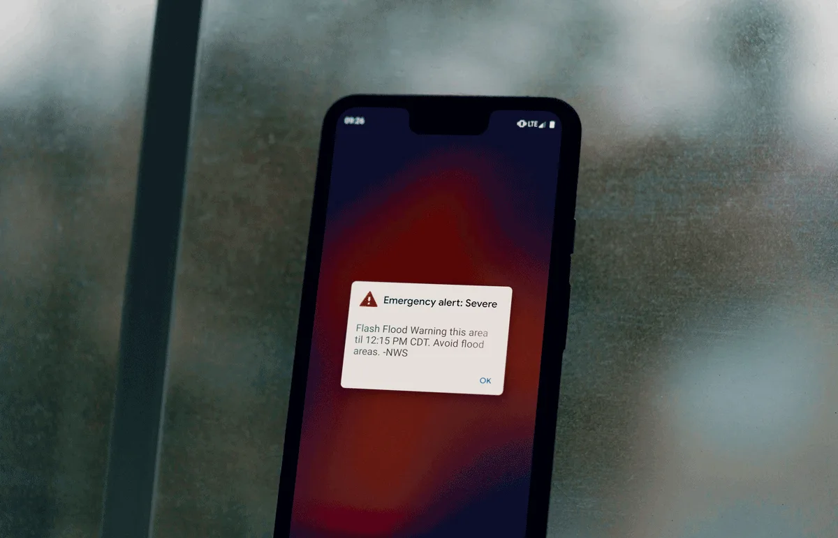
1. Real-Time Emergency Evacuation Notifications:
There are many tools in the public safety space for managing communication with the community, both formal (mass notification systems) and informal (social media).
Emergency evacuation software like Perimeter makes information clearer and easier to interpret, but integrations alongside these tools are important for ensuring access to critical information is distributed as widely as possible.
2. Emergency Response Management
Here are the critical features that aid in managing the evacuation process during emergency situations and can be visualized using emergency mapping software:
- Preplanned zones: Delineation of the population into zones based on geography, done in advance and generally covering all or most of the relevant jurisdiction. Preplanned zones generally are shaped around local population centers, and are used to order evacuations in different stages to maintain order during an incident.
- Ad hoc zones: Created on-the-fly rather than advance, usually to warn or evacuate a target area based on the effects of a specific incident.
- Routes: Highlights relevant roads, either to mark road closures or recommended routes.
- Points: These are used to mark individual pieces of data, like resource distribution or shelter sites, or hazard data like road closures or incident markers.
- Impact areas: Borders drawn around an incident area to indicate where response efforts are focused.
- Evacuation Planning: It should allow emergency managers to create and simulate evacuation plans for different scenarios based on different types of emergency situations. This helps in identifying optimal evacuation routes as well as estimating evacuation times.
3. Critical Integrations
It is crucial for emergency evacuation software to integrate with adjacent tools in the event of a disaster, in order to facilitate crisis communications rapidly and effectively.
Here are some examples of such integrations.
- GIS (Geographic Information System): Integration with GIS allows emergency managers to visualize data such as maps, infrastructure, and hazard zones.
- Weather Data Services: Integration with weather data services provides real-time information about weather conditions, forecasts, and severe weather alerts.
- Communication Channels: Integration with communication channels such as social media monitoring tools enables effective communication with emergency responders and helps facilitate timely dissemination of information and instructions during emergencies.
- Emergency Notification Systems: Integration with emergency notification systems allows emergency managers to send alerts, warnings, and updates to residents, businesses, and organizations via various channels including SMS, email, voice calls, and mobile apps.
- Resource Management Systems: Integration with resource management systems helps in tracking and managing essential resources such as personnel, equipment, supplies, and facilities during emergency response operations.
- Incident Reporting and Management Tools: Integration with incident reporting and management tools enables the capture, documentation, and tracking of incidents, including their location, severity, and status.
How To Evaluate Emergency Evacuation Solutions
- Define Requirements: Outline the requirements and objectives for the emergency evacuation solution, while considering factors like the size and the population, regulatory compliance requirements, budget constraints, and any unique considerations.
- Compare Vendor Solutions: Consider factors such as features, functionality, scalability, vendor reputation, data security, pricing, customer reviews, and case studies.
- Integration with Critical Systems: Ensure the vendor supports integration with developed channels such as social media platforms, mass notification tools and other types of emergency management software that might be used in the event of a disaster.
- See a Live Demo: Reach out to vendors and see the product in-action. Pay attention to how well the solution addresses your specific requirements, usability, customization options, integration capabilities, and interagency collaboration.
- Usability and User Experience: Assess factors such as ease of use, intuitiveness of the interface, clarity of instructions, and accessibility for individuals with diverse needs.
- Mobile App: The software must include a mobile app for users and responders. Something that has access to all core functionality but can be easily used closer to the frontlines or on the go as needed. Web based applications should provide access for users in an administrative environment, with access to all of the application features and be accessible on any desktop device (Windows, Mac, etc.)
- Vendor Support and Training: Evaluate the level of customer support and training provided by the vendor. Consider factors such as availability of technical support, response times for inquiries or issues, training materials, user documentation, and ongoing support options.
- Pricing Structure and Fees: Pricing models and budgetary considerations should be carefully evaluated before choosing an evacuation management system. Things like annual subscription fees, per-user costs, scalability and tiered pricing models should be taken into consideration.
- Assess Return on Investment (ROI): Evaluate the total cost of ownership for the evacuation solution, including initial setup costs, licensing fees, maintenance fees, and any additional expenses. Consider the potential return on investment in terms of improved safety, operational efficiency, regulatory compliance, and reduced risk exposure.
- Case Studies and Success Stories: Any reputable vendor should have plenty of real-world examples of how the software has helped public safety organizations in emergency situations. These case studies should showcase the platform’s critical capabilities.
- Cloud-based Infrastructure: Reliability and resilience are critical during a disaster and for public safety agencies during day to day operations. Technology failures and down time during critical events are not acceptable.
- Peace of Mind and Assurance in Emergency Preparedness: Comprehensive planning and the ability to make changes in “real time” are critical to community peace of mind and the safety and security of response personnel.
- Data Security: All data should be secured to Advanced Encryption Standard (AES) both in transit and at rest.
Perimeter — The Ideal Emergency Evacuation Platform
Perimeter is the ideal partner in evacuation management, empowering emergency managers and responders to address the most important aspect of disaster response and recovery: saving lives.
Here are five reasons why Perimeter is the top choice for public safety organizations.
1. Interagency collaboration
Perimeter enables efficient interagency collaboration, team management, and the ability for different counties to seamlessly work together in the future. This ensures streamlined operations and improved coordination among fire, law enforcement, and emergency management agencies.
2. First responder communication to the public
Perimeter facilitates real-time evacuation updates and other emergency communications to residents, offering an intuitive platform that makes it easier to publish essential information and updates, enabling timely and transparent communication channels between emergency services, news outlets, and the residents they serve. The platform is an important resource for public information officers.
3. Accessibility
Perimeter addresses the issue of inaccessibility prevalent in current systems by focusing on enhancing accessibility. Perimeter eliminates the need for prior opt-ins, sign-ups, resolves language barriers, and provides visual guides for residents while being specifically designed for mobile interfaces, ensuring that critical information and services are readily accessible to all users, regardless of their prior engagement or device preference.
4. Time saved
Perimeter emphasizes time savings for both emergency managers and the public.
By eliminating the need for up to 12 hours of work typically required by current emergency managers and GIS technicians at the onset of a disaster, Perimeter enables swift and efficient information sharing.
This empowers emergency managers to quickly respond and provide the public with timely updates, ultimately enhancing overall emergency response and reducing the potential impact of the disaster.
5. Usability
Perimeter prioritizes usability, providing a user-friendly platform specifically designed for mobile devices with offline capabilities.
By offering an intuitive interface and seamless navigation, Perimeter ensures emergency managers can efficiently utilize the interface without the need for GIS technicians, saving both time and money.
Emergency Evacuation Software FAQs
What does emergency evacuation software actually do? How does it work?
- Emergency evacuation software is a map based solution that allows response personnel and emergency managers to create geospatial information in real time during a disaster.
- Effective emergency evacuation software supports pre-planning to include evacuation zones, evacuation shelters, evacuation routes, and other fixed facilities that are developed during planning activities.
- Effective emergency evacuation software supports the creation of map information by authenticated users in real time during a disaster in order to support the needs of dynamic situations.
What types of emergency situations does the software address?
- Effective emergency evacuation software is built around the concept of “all hazards” response.
- Effective emergency evacuation software can support response, mitigation, and recovery for any emergency situation.
Does it offer functionality like access control and real-time evacuation plan viewing?
- Access control and facilities level evacuation plans are related to workforce management solutions; these features are not relevant to population management solutions used by government agencies.
How does the software contribute to overall peace of mind and public safety?
- Emergency Managers have an enhanced ability to communicate critical information with the community in real time.
- Emergency Managers can readily inform the public about the steps they have taken to plan and prepare for both disasters and planned events.
Is there any difference between emergency management software vs. evacuation management software?
- Emergency Management refers to the overall coordination of a response to an emergency or disaster; to include the functions of Planning, Operations, Finance, and Logistics.
- Evacuation Management refers to planning and executing the evacuation of at-risk and impacted populations in advance of (and during) an emergency or disaster.
What’s the difference between workforce management vs. population management?
- Workforce Management is focused on emergency management for commercial facilities and campuses to include: employee roll calls, evacuation plans and access management functionality during localized emergencies.
- Population Management is focused on communicating hazards, evacuation zones, evacuation routes, shelters, impact zones, and resource distribution sites to the community during planned events and disaster responses.
Perimeter FAQs
What is Perimeter and what does it actually do?
- Perimeter is a map based public safety collaboration and evacuation management tool that is used by emergency management teams and first responders during planned events and large scale emergencies.
- Perimeter supports simple bidirectional integration with other platforms and solutions to ensure that there is a single source of truth during all events.
What makes Perimeter different from other types of emergency management and mass notification systems out there?
- Perimeter is simple, intuitive, and easy to use.
- Perimeter is device agnostic and can be used on iOS, Android, and Windows devices.
- Perimeter allows real time updates and changes independent of pre planned and pre populated information.
- Perimeter is not a mass notification system, however, Perimeter integrates easily into existing mass notification platforms.
- Perimeter allows information sharing across jurisdictional and disciplinary boundaries.
How does Perimeter assist coordination and communication with emergency responders in different jurisdictions?
- Emergency management cannot be done by one jurisdiction (county, city, state) in a vacuum — especially given that often larger incidents are spilling over traditional boundaries these days. It’s important for emergency evacuation software to enable easy collaboration in the event that a neighboring agency is brought in to support the response effort.
Who are typically the best fit customers for Perimeter?
- Counties that have the desire to enhance collaboration and communication within the public safety sector and enhance their ability to communicate with the constituents that they serve.
Which use cases are not serviced by Perimeter?
- Perimeter is an all-hazards solution that can be tailored to virtually any use case population based emergency management use case
- Perimeter is not intended for use as a facility level emergency management solution:
- For example, Perimeter is not intended to facilitate building evacuation plans, roll call and check-in during drills and emergencies, access control system integration, etc.
Which systems and tools does Perimeter integrate with?
- Perimeter supports real time integration via shared map layers or feature services and can be integrated with virtually any map based solution.
What factors influence Perimeter’s pricing?
- Perimeter offers a tiered pricing model based on population and is an enterprise solution that is sold by agency with no per user costs.
- Perimeter can be scaled up or down based on current situational needs.
What is the onboarding process like with Perimeter?
- Perimeter team members work with agency personnel to develop or upload pre planned evacuation zones and other pre planned incident resources such as shelters and resource distribution centers.
- Perimeter provides administrative and end user training in the use of the solution.
- Perimeter recommends and supports a tabletop exercise to build user skills using a crawl, walk, run methodology.
- Perimeter collaborates with customers to develop policies and relevant use cases relevant to the use of the solution.
- Perimeter provides ongoing best in class customer support throughout the business relationship.